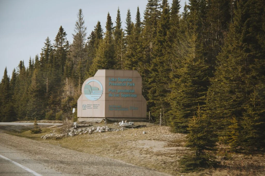
The Ultimate Guide to Lake Superior Provincial Park
I’m not sure exactly when I fell in love with Lake Superior Provincial Park. It might have been the first time I camped there when the sun was dipping low over the great span of Lake Superior, lighting the Jack Pines behind me aflame. Or it might have been when I crawled out of my sleeping bag on a crystal clear night to photograph the impeccable stars. Or it might have been the night I fell asleep to the sounds of huge waves crashing into the beach. The point is I fell in love, and I want you to fall in love with Lake Superior Provincial Park too.

This guide to Lake Superior Provincial Park is not a replacement for the information you can easily research on Ontario Parks or at an Information Centre, but to help plan your time there and make the most of this amazing provincial park.
Until recently, I thought I didn’t need to visit Lake Superior Provincial Park because I had already “seen” it as I drove through multiple times on a cross-Canada road trip. I had stopped at the famous Old Woman Bay beach and at the numerous lookouts along the Trans-Canada Highway.
It wasn’t until my first camping trip here that I realized how much I was missing! From hiking all the incredible trails, to stargazing in some of Canada’s darkest skies, to enjoying all the scenic views, there are so many amazing things to do at Lake Superior Provincial Park that you’ll want to stay a whole week (like I did)!
Why visit Lake Superior Provincial Park
Lake Superior Provincial Park stretches from Sault Ste Marie in the south to Wawa in the north and encompasses more than 1,500 square kilometres of pristine wilderness on both sides of the Trans-Canada Highway.
This was the last section of the Trans-Canada Highway to be built in Ontario and is known as “The Gap” since it was still rugged and mostly inaccessible. In fact, when the park was created in 1944, there was no road to access it.
Today, this section of the Trans-Canada Highway is one of the most scenic in Ontario. I mean, who can beat these views over the turquoise waters of Lake Superior, the coldest and deepest of the Great Lakes.
Lake Superior Provincial Park offers activities for all levels, whether you want to lounge on a sandy beach, hike through forests, scramble up to viewpoints, canoe on the Lake, or take to the backcountry wilderness.
You’ll be surrounded by the Algoma Highlands mountain range (yes there are mountain ranges in Ontario) which showcase breathtaking scenery of the Canadian Shield. This area was so beloved by the famous Group of Seven Canadian Painters, that it is the subject of many of their paintings.
How to get to Lake Superior Provincial Park

The only way to get to Lake Superior Provincial Park is by vehicle. It’s located nearly 10 hours from Toronto and 6 hours from Thunder Bay.
Since you’ll be driving here, it’s important to note that there are no gas stations along this 200km stretch of highway, so be sure to fill up in Sault Ste Marie before your head north, or Wawa before you head south.
I also highly recommend that you do not drive this stretch of highway at night. There are no street lights because you’re in the wilderness and it’s very likely you’ll encounter wildlife along the way. It’s a huge hazard and in a competition between a moose and a car, the moose would win.
RELATED: 31 Best Places to go Camping in Ontario
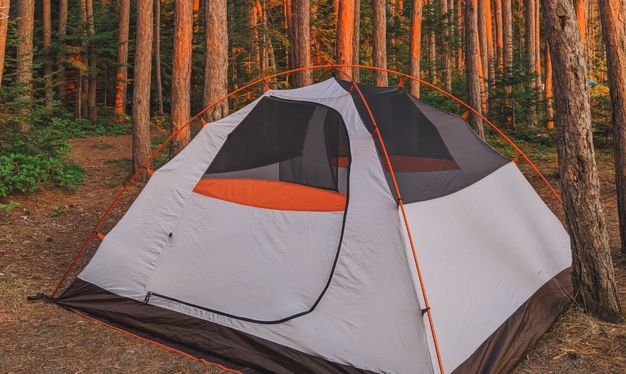
Best campsites in Lake Superior Provincial Park

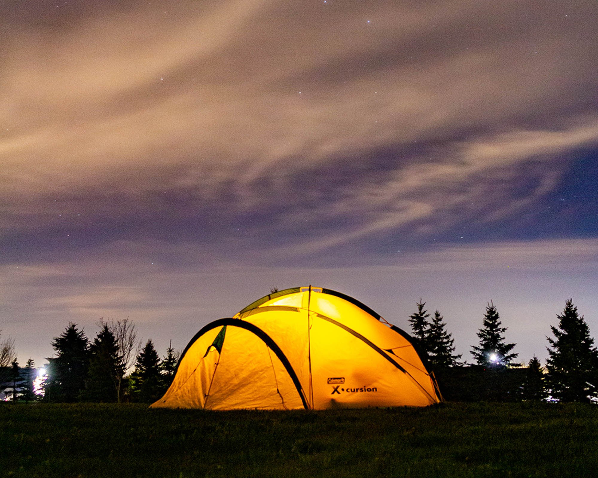
The best way to experience Lake Superior Provincial Park is to stay a few days. There are two main campsites in Lake Superior Provincial Park: Rabbit Blanket Lake and Agawa Bay campgrounds. Both are gorgeous, but I have to admit that Agawa Bay is my favourite! To book a campsite here, you’ll have to reserve a site up to five months in advance on OntarioParks.com.
Rabbit Blanket Lake Campground is on the northern end of Lake Superior Provincial Park, situated on an inland lake. There are 60 sites here, so it’s much smaller than Agawa Bay. Rabbit Blanket is the launching off point for the Peat Mountain Trail and for those who want to canoe the inland lakes.
Agawa Bay Campground is located along a stretch of sandy beach shoreline of Lake Superior in the southern part of the park. There are 147 sites here and many of them have fantastic views of the water. While this is the busier park, the campsites are relatively private. When here, you’ll likely have to deal with the high winds that blow in over the lake, so keep that in mind when choosing your gear and how you set up camp.
There are 163 backcountry campsites located within the boundaries of Lake Superior Provincial Park. These sites can be accessed by either a hiking trail or canoe route. The sites are divided into zones and you have to reserve a site within a zone in advance.
RELATED: The 37 Best Hikes in Ontario
The Best Hiking in Lake Superior Provincial Park
Lake Superior Provincial Park offers some of the most pristine hiking in all of Ontario as the trails here take you along all the incredible landscapes that make up this park, from its rugged shoreline to the sandy beaches, the isolated lakes, its dense forests, the wildlife-loving wetlands, and, of course, the peaks of this old mountain range.
While I have not completed all of these trails (some of them are still on my bucket list), I’m listing all 11 trails that are part of Lake Superior Provincial Park, so that you can decide which trails you would like to hike when you visit. The ones I have hiked, I’ve given a further description to and offered some tips.
The trails below are listed in order from North to South, with many of the access points off of Highway 17 (aka, the Trans-Canada Highway).
Nokomis Trail

Distance: 5km
Rating: Moderate
Features: Impeccable views of Old Woman Bay
If there’s one hike that you do in Lake Superior Provincial Park, make it this one. There’s a reason that Nokomis Trail is listed as Lonely Planet’s top 5 day hikes in CANADA. Start this loop trail at the day-use parking lot for Old Woman Bay.
I suggest getting there early and starting this trail in the morning. Not only because the parking lot will be emptier, but the sun will be mostly at your back and you can see the sun hit the Bay!
You have to cross the highway to get to the trailhead, so be careful as this is a major highway and can get very busy. Once you hit the trailhead you come to a fork in the trail. GO RIGHT. It is much easier to hike this trail counter-clockwise, as it’s a more gradual climb up the 200ft cliff than if you go the other way. I ran into several people who turned left and they were regretting it.
Once you make it up the backside of the cliff, you’ll be treated with your first view looking south over the rolling hills. From there the trail is relatively easy as you continue a gradual climb to the ultimate lookout over Old Woman Bay.
Then you’ll start the trek down. It’s a steep grade, which can be tough on your knees, but it’s a relatively short distance before you’re back at the trailhead.
I can’t get over how amazing this hike is. Definitely one of my top 10 for sure!
South Old Woman River Trail
Distance: 2.5km
Rating: Moderate
Features: A trout stream
This relatively easy hike follows along the South Old Woman River, which is a great place to spot brook trout. Because the trail follows the water, the trail itself can be slippery from time to time. Depending on the time of year, you should be able to see lots of moisture-loving ferns, mushrooms and wildflowers.
RELATED: Best Ontario Parks to visit in the Winter
Peat Mountain
Distance: 11km
Rating: Demanding
Features: Stunning views over Rabbit Blanket Lake and Peat Lake
For the first half of the hike, you’ll want to turn around, since most of it heads uphill and continues to go uphill until you read the third viewpoint. The views are outstanding and the trail takes you through beautiful hardwood forests that turn colour in the fall.
At 531m (1,600ft) tall, Peat Mountain is the tallest peak within the park’s boundaries. So if you make it to the top, then you can cross “summit a mountain” off your bucket list.
There is a side trail to Foam Lake Lookout, a 45-minute addition to your hike.
Trapper’s Trail

Distance: 1.5km
Rating: Easy
Features: A possibility of wildlife
This easy, short hike takes you along the edge of Rustle Lake, which is known for its abundance of wildlife. You’ll come to two viewing platforms and a neat boardwalk that you can try to spot wildlife from. The park recommends a quiet hike at dawn or dusk with binoculars for your best chance.
Quick reminder: wild animals are wild and unpredictable. Maintain a good distance.
I, unfortunately, did not see any animals on my trek during the middle of the day. But I can’t help but be okay with that since I was on my own AND there was no one else on the trails. I would have probably peed my pants if I came across a moose or a bear.
Orphan Lake Trail
Distance: 8km
Rating: Moderate
Features: Incredible terrain, waterfalls and viewpoints!
The Orphan Lake Trail offers a huge variety of terrain, from the hardwood forests, rocky shore of Lake Superior and waterfalls!
The trail takes you along an incline until you get to your first viewpoint over Orphan Lake, then through a burned area that is slowly recovering. At the top of this burned area, you’ll get an incredible view over Lake Superior, before making it back down to the shoreline. The Baldhead Beach area is the halfway mark and a great place to sit for a picnic.
This point of the trail intersects with the Coastal Trail. After lunch, follow the trail along Baldhead River to the cascade waterfall. Then make sure you follow signs for Orphan Lake, not the Coastal Trail, or you’ll end up hiking a lot longer than you intended.
The trail then climbs back up to Orphan Lake before you come back to the parking lot.
Pinguisibi Trail

Distance: 6km
Rating: Easy
Features: An awesome waterfall!
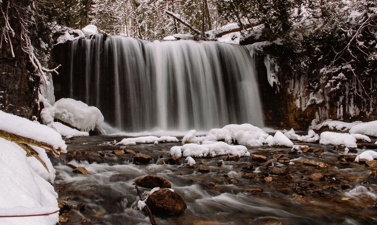
If you just passing through Lake Superior Provincial Park, then you won’t want to miss this easy trail located right off the Trans-Canada Highway. This trail follows a traditional Ojibwe canoe route along the Sand River, aka, Pinguisibi - a “river of fine white sand.”
White the total distance for this in-and-out trail is 6km, you can cut that in half if you just visit the first waterfall, which is only a short hike upstream from the parking area. The trail does continue, however further along to two more waterfalls and ends at portage 28 of the Sand River Canoe Route.
Agawa Rock Pictographs Trail

Distance: 0.5km
Rating: Moderate
Features: Pictographs!
The Agawa Rock Pictographs Trail is a short, yet very rocky trail that leads you down to the shoreline of Lake Superior to see the amazing Ojibwe pictographs. These red ochre paintings at this sacred site showcase several drawings of people, canoes and animals. The main feature of the pictographs is Mishipeshu, the Great Linx, also known as the spirit of Lake Superior.
You can only view the pictographs from an uneven rock ledge that descends at an angle into Lake Superior. Because of this, you can only get out on the ledge when the lake is calm, as Lake Superior is known for its unpredictability. There is a rope that you can hang onto, and a diagram of all the pictographs if you can’t go out to view them.
The trail also offers a glimpse into the volcanic history of the area.
RELATED: The Complete Guide to Tobermory and Flowerpot Island Camping
Awausee Trail
Distance: 10km
Rating: Demanding
Features: Views on views on views!
Unfortunately, as of 2022, this trail remains closed. Keep an eye out for when it re-opens!
The Awausee Trail is about 10km and offers incredible views of the Lake Superior shoreline. It’s a tough climb since you start at the base of Agawa Mountain and climb along an old logging road and through a ravine to a series of lookouts 200m above the Agawa Valley.
If you don’t want to commit to the full 10km, a shorter journey takes you to the first lookout and back. Ontario Parks recommends 45mins for the shorter route.
Towab Trail
Distance: 24km
Rating: Very Demanding
Features: An enormous waterfall!
If you want to get your feet wet with backcountry camping in Lake Superior Provincial Park, then why not hike the Towab Trail and stay overnight near the base of the Agawa Falls. The trail takes you along the Agawa Valley, as you follow the river for much of the trek to Agawa Falls, one of the highest waterfalls in the park at 25 metres high.
The trek takes you all the way to the falls and back, which totals about 24km of very demanding trail. You might also be able to hear (but not see) the Awaga Canyon Tour Train.
Crescent Lake Trail
Distance: 2km
Rating: Easy
Features: Old Forests and Lakes
Crescent Lake Trail is located at the old Crescent Lake Campground. It’s an easy trail that takes you along an old Birch and Pine forest and around a couple of lakes. Crescent Lake is also the jumping-off point for the Crescent Lake canoe route.
RELATED: Everything you need to know about Pukaskwa National Park
Coastal Hiking Trail
Distance: 65km
Rating: Very Demanding
Features: multi-day
If you’re into multi-day hikes, the Coastal Hiking Trail in Lake Superior Provincial Park might just be one of the best in Ontario. While there are several access points - Agawa Bay, Sinclair Cove, Katherine Cove, Coldwater River, Orphan Lake Trail and Gargantua Road - The most common route is from Gargantua south to Agawa Bay.
Even if you do the most common route, you haven’t hiked the whole trail, since there is a section (14km there and back) that heads north to Chalfant Cove to complete the trail.
Everything south of Gargantua is considered very demanding, as it follows the incredibly rocky and steep shoreline of Lake Superior. But, all the coastal campsites are located on secluded beaches that you can only experience by getting there on foot (or in a canoe)!
If you’re up for the challenge, you’ll have to get a backcountry permit and I suggest purchasing a trail map!
Other amazing things to do in Lake Superior Provincial Park
As you may recognize, there are some seriously amazing trails in Lake Superior Provincial Park. But what if you’re not that big into hiking? What other things can you do in Lake Superior Provincial Park? Well, It turns out there’s a lot!
Drive the Trans-Canada Highway

There are numerous places in Canada that make lovely scenic road trips, and the shoreline of Lake Superior Provincial Park is one of them. In the southern half of the park, the Trans-Canada Highway hugs the shoreline, giving you spectacular views over the water. In the northern half of the park, the Highway turns inland and you get to experience some of the incredible scenic views of the Algoma Highlands mountain range. There are numerous spots to stop and take pictures too!
RELATED: Toronto to Thunder Bay: a 10-day Northern Ontario road trip along Lake Superior’s spectacular coast
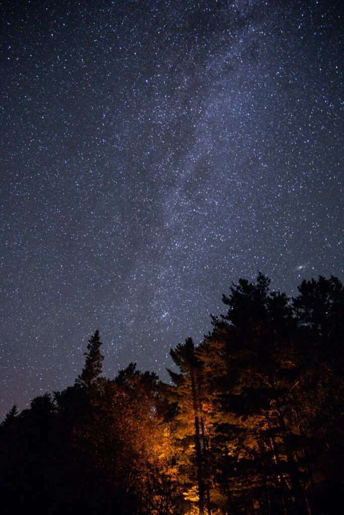
Stargazing in Lake Superior Provincial Park

When you’re in Lake Superior Provincial Park, you feel like you are in the heart of Ontario’s wilderness. And you are. There are not too many towns located nearby, which makes this the perfect place to set up a chair and watch the night sky unfold.
Lake Superior Provincial Park was designated as an official Dark Sky Preserve in Canada in 2018. Both campgrounds in the park are great viewing areas.
RELATED: Travel to Dark Sky Preserves in Canada and see the stars without light pollution
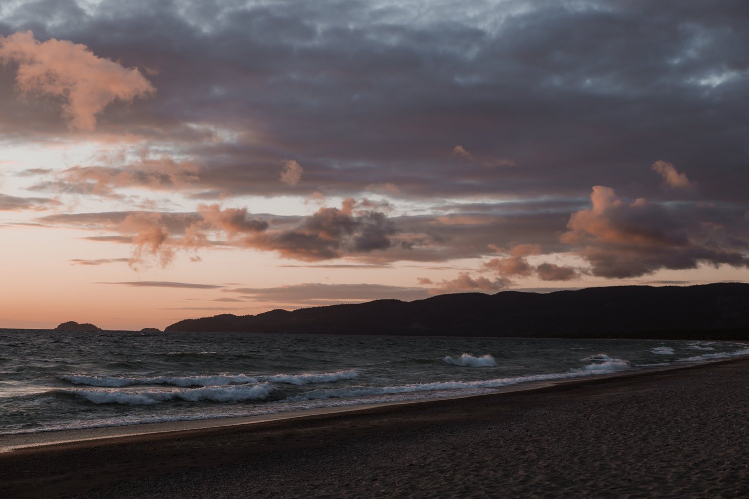
Sunsets at Agawa Bay

The sunsets on Lake Superior are phenomenal and you won’t want to miss it. That’s one of the reasons I love staying at the Agawa Bay campground. The sites are just steps from the beach and everyone likes to make their way down to the beach with a chair and a blanket to watch the sun dip below the horizon.
Don’t forget to look behind you too, because the setting sun lights up the Jack Pines, making them look as if they were on fire.
Lounging at Katherine Cove

A sandy beach? Sparkling blue water? Count me in. After a full day of hiking and exploring, it’s time to relax at Katherine Cove, known for the famous Bathtub Island.
Katherine Cove is a shallow sandy cove that is perfect for swimmers. On a calm day, you can walk right out to Bathtub Island, an island made from a slab of rock with a depression in it, making a shallow bathtub for swimmers!
On a windy day or when the waters are rough, you’ll have to stay close to shore, since the waves and riptides can be unpredictable. But it’s worth the trip, just to see the power of the waves.
RELATED: Beginner’s guide to camping + camping essentials + recipes
Picnic at Old Woman Bay

Old Woman Bay is located in the northern half of the park. This day-use area is the perfect place for a picnic, with its bright, soft sand and gorgeous surroundings. Looking south, can you see the old woman’s face in the cliffs that this place was named after?
Old Woman Bay is also the starting point for the Nokomis Trail.
Learn at the Visitor Centre
Don’t miss visiting the Visitor Centre, located at the Agawa Bay campground. This beautiful wood and stone building near the Agawa Bay campground showcases Lake Superior’s power through the park’s cultural and natural history. The exhibits are beautiful and it’s the jumping-off point for guided hikes and the park’s Discovery Program.
Plus they have a huge map in the entrance that shows you how large this place really is!
RELATED: Best Gifts for Outdoorsy People – Gifts for Campers, Hikers and Adventure Travellers
Canoeing in Lake Superior Provincial Park
Another way to explore Lake Superior Provincial Park is by canoeing or kayaking! There are eight canoe routes in the park, with easy day trips to expert-level multi-day routes. You can decide to canoe on the inland lakes or the rugged, unpredictable Lake Superior coastline.
If you do want to take your canoe out, then you have to get the route maps and descriptions from the Parks Store.
Despite having passed through Lake Superior Provincial Park half a dozen times on family road trips, I hadn’t really experienced the park until camping there when I was older. And it wasn’t until I spent a week in Lake Superior Provincial Park by myself, that I really discovered how many incredible things this park has to offer (and I still haven’t seen it all)! You won’t want to miss hiking, stargazing or any of the other amazing things to do in Lake Superior Provincial Park.


![Everything you need to know about Pukaskwa National Park [+ hiking guide]](https://images.squarespace-cdn.com/content/v1/6495d3b60f950e6c0e7c842f/1687544873523-A8Z7P3OTJ503YPBVEG7C/guide-to-pukaskwa-national-park.jpg)
![Beginner's guide to camping + camping essentials + recipes [free checklist]](https://images.squarespace-cdn.com/content/v1/6495d3b60f950e6c0e7c842f/1687545649255-ZI06656IWYUR3MS8696D/beginners-guide-to-camping-1024x612.jpg)


Discover the largest freshwater island in the world. This one-week itinerary will help you find the best things to do on Manitoulin Island, places to stay, where to eat and more.