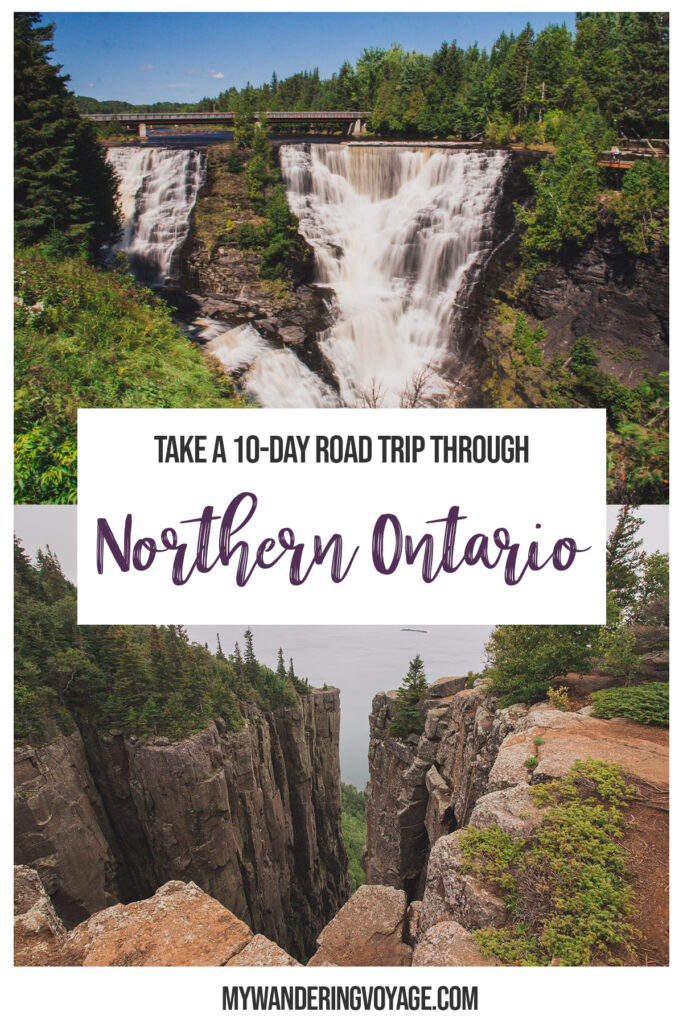
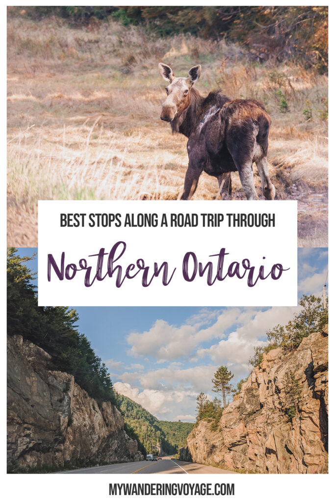
There’s nothing quite like Lake Superior, the largest, deepest and coldest of the Great Lakes. It’s one of Ontario’s most rugged coastline. This 10-day Northern Ontario road trip will take you to spectacular vistas, magical waterfalls, and must-see places along Lake Superior. Start the car, and let’s go!
NOTE: Travel is not recommended at this time. These posts are here to serve as inspiration when we can explore again. Hey there – this post likely contains affiliate links, which means I earn a commission (at no extra cost to you) if you purchase from them. This helps me earn a few dollars to run this website.
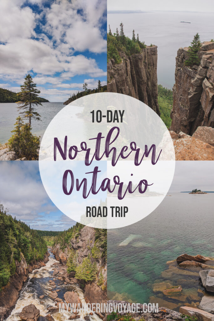
I walked out to the edge of the platform, the ground 130m (426 feet) below me. The wind whipped my hair and my clothes as I stared out over Lake Superior, feeling like a soaring bird, smiling from ear-to-ear. This moment, standing on the Thunder Bay lookout, was why I wanted to take a northern Ontario road trip to see the best of the best along the shores of Lake Superior.
But it’s far. From Toronto to Thunder Bay, it was 3,550 kilometres of driving. Throughout this 10-day Northern Ontario road trip, we visited 14 provincial parks, saw 11 waterfalls, walked 118 kilometres and took a whopping 1,202 photos.
This guide will give you everything you need to know to make this Lake Superior road trip, where to stay, what to see, and must-see stops to see along the way. If you love waterfalls, hiking and stunning vistas, then this itinerary is for you!
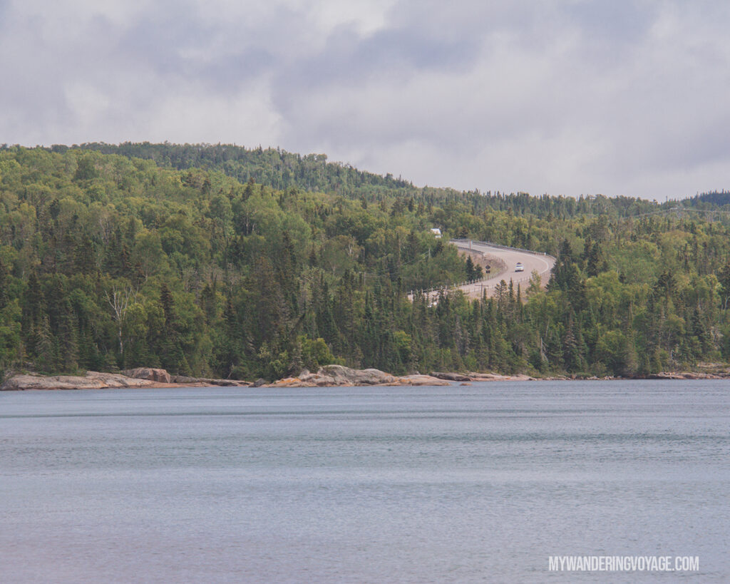
Toronto to Thunder Bay driving distance
No matter where you’re starting your trip from, Toronto is a popular starting point. A Toronto to Thunder Bay road trip will take days. The Toronto to Thunder Bay driving distance is just over 1,380km and can take anywhere from 15 to 20 hours straight.
But you don’t want to just drive to Thunder Bay; you want to see the sights! That’s why we took 10 days to see as much as we could, and we still didn’t scratch the surface!
What you need to know about a Toronto to Thunder Bay road trip
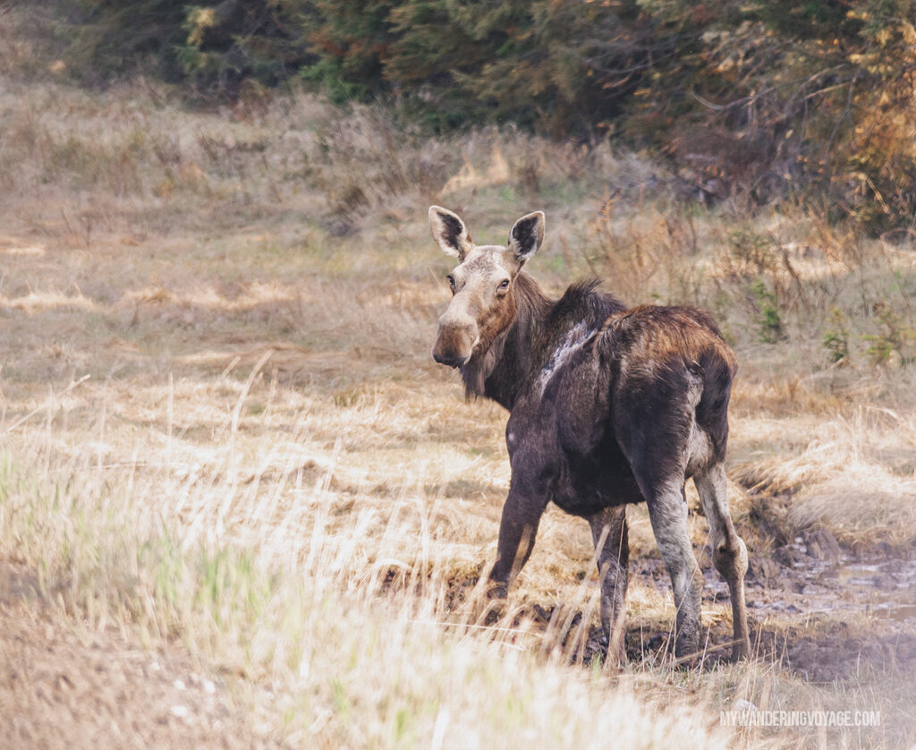
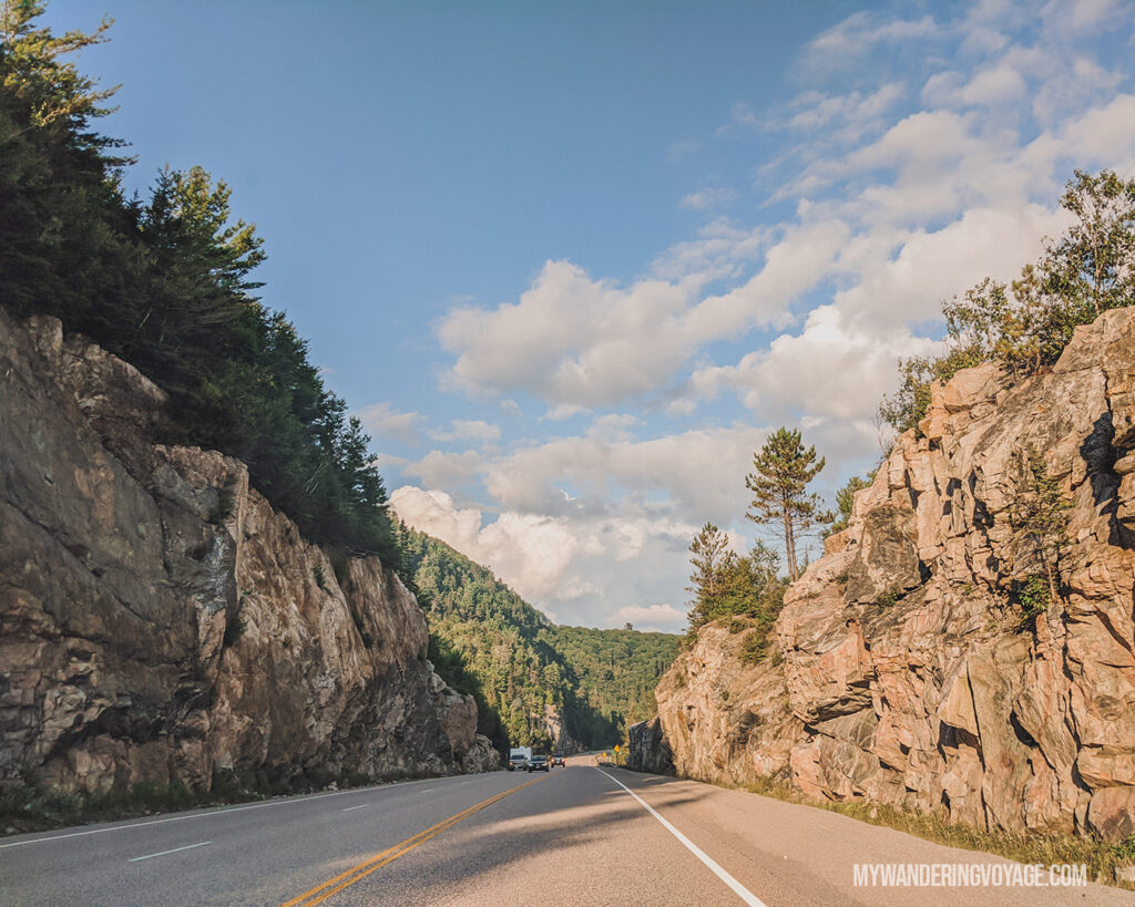
Driving along Ontario’s northern routes is a lot different than driving in southern Ontario. Once you pass Sudbury, the highway is reduced to a two-lane road for most of the journey. Not only are there plenty of natural driving hazards, like wildlife, weather and falling rocks, but also other dangers like fatigue and bad drivers.
On one of my cross-Canada road trips, there was an accident about 30 minutes west of Sudbury. The police had closed the road, and we were stuck in traffic that stretched 15 kilometres for two hours. There was just no way around it.
There are also huge swaths of the road where you won’t see a gas station or buildings for that matter.
The point is, there are plenty of things you need to prepare for before you head out on a road trip. You also need to be aware of the dangers that exist on these northern roads.
RELATED: Road trip tips: What you need to know about taking the perfect cross-country road trip
Should you camp or stay at a motel?
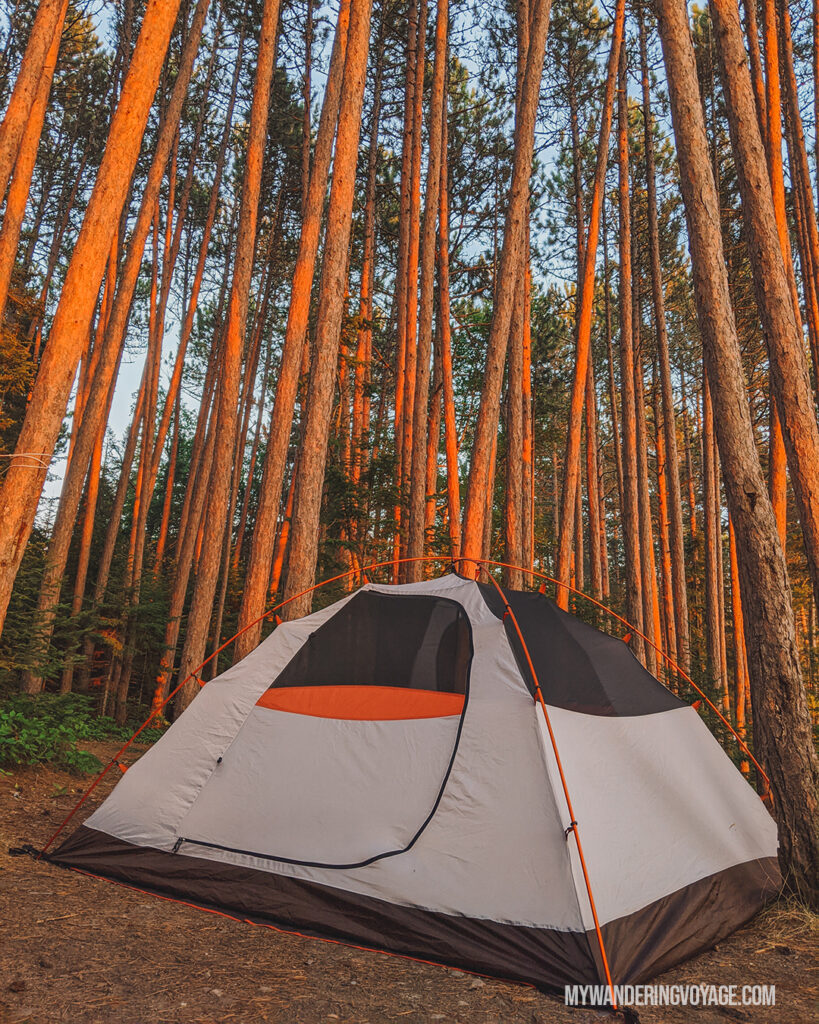
Northern Ontario doesn’t have a ton of options when it comes to staying overnight. There are very few hotels, which are mostly concentrated in the larger towns. There are many motels, both good and bad, scattered along the highways. But there are plenty of places to camp.
I’ve done this trip both ways, staying in motels and camping, and while I personally prefer camping, I know it’s not for everyone.
If you stay in a motel, you’ll have a bed to sleep in, you won’t have to worry about wildlife getting into your food, and you’ll have access to amenities, among other things.
If you camp, you’ll be in some of Ontario’s most beautiful parks, surrounded by nature. Plus, it’s much less expensive than a night at a motel.
RELATED: Beginner’s guide to camping + camping essentials + recipes
Lake Superior road trip map
It’s tough to picture how large northern Ontario is without looking at a map. Given that most of Ontario’s inhabitants live in the southern half of the province, some road maps leave off the northern half.
When you’re heading out on a 10-day Northern Ontario road trip, you’re going to want to get a paper map of the Lake Superior area and a printout of the places you’re headed. Cell service is spotty at the best of times, and in many places, it’s non-existent. A detailed road map and a non-internet-based GPS will be the best alternative to using Maps on your phone.
For a list of all the places I’ve mentioned in this 10-day Northern Ontario road trip, check out this map:
10-day Northern Ontario road trip
I hope you’re up to an action-packed, adventure-driven 10-day Northern Ontario road trip. This trip will bring you to incredible vistas, stunning waterfalls and gorgeous parks.
Depending on where you’re leaving from, this Toronto to Thunder Bay road trip guide assumes you’re driving from the Greater Toronto Area. While I don’t live in the GTA, I recognize that more than 40% of Ontario residents live in the GTA, so this guide starts from there.
And while there is PLENTY to see from Toronto to the Sudbury area, especially the gorgeous Muskoka region, this trip will gloss over most of that to get you up north as quickly as possible.
RELATED: The ultimate road trip packing list (+ free checklist)
Day one: Gateway to the North
Driving time: 3 to 5 hours
Distance: <400km
Day one of the Toronto to Thunder Bay road trip will take you along Highway 400 to Sudbury. You’ll be passing through some of Canada’s most beautiful scenery, like the Muskoka region, but there are very few stops today. While there is a lot to do and so much incredible scenery in this region of Ontario, to fit everything else into the 10-day Northern Ontario road trip is to pass almost everything on this stretch to bring you north as quickly as possible.
The good news is that this region is accessible and can be visited on shorter trips. So, where should you stop on this stretch?
Parry Sound
Parry Sound is a great half-way mark on your first day. Not only is there a gas station with a Starbucks right beside it, but there’s actually quite a lot to see here. Set along Georgian Bay’s shores, this bustling town has a lovely downtown, with a few restaurants and cafes to stop for a bite to eat, such as Bay Street Café and Trestle Brewing Company.
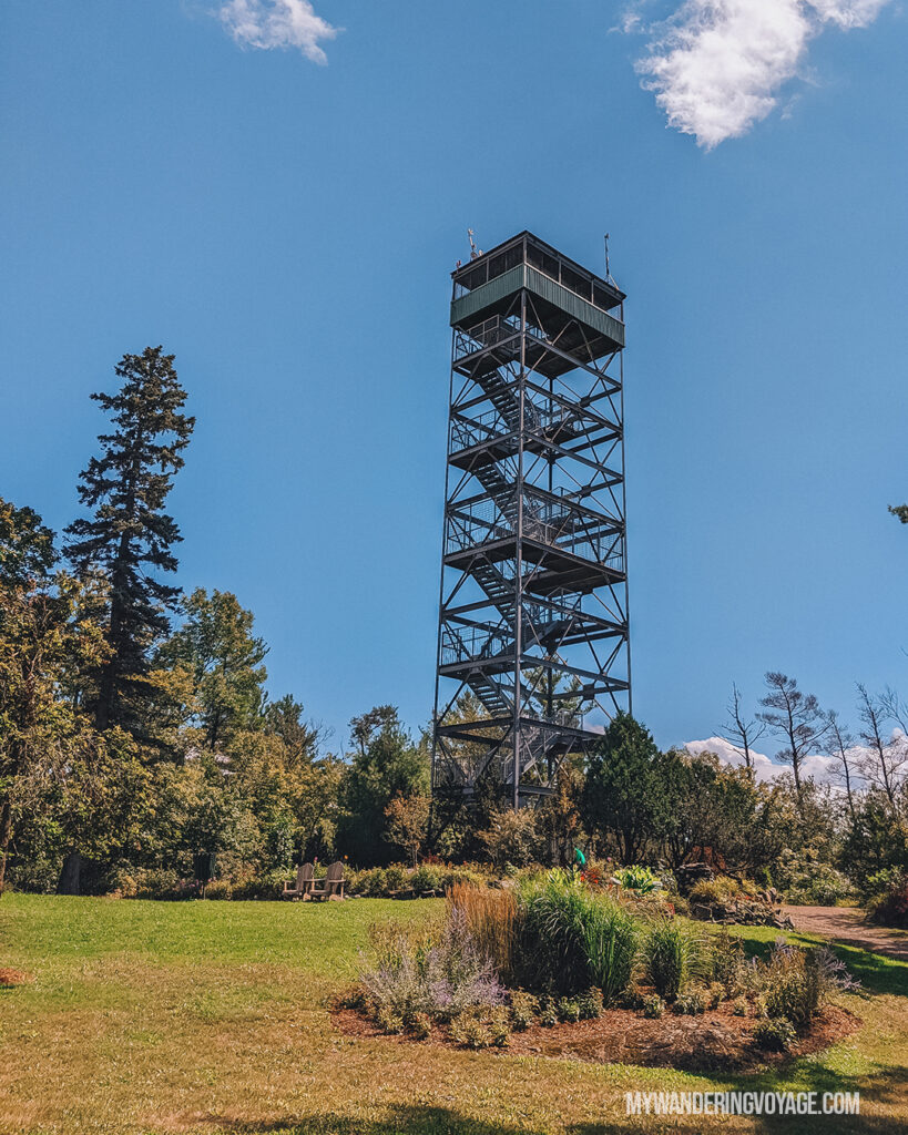
But the one thing you should definitely stop for is Parry Sound’s scenic lookout tower at Tower Hill Heritage Garden.
Located near the West Parry Sound District Museum, this 30-metre tall fire tower offers views of the surrounding Georgian Bay. Climb the 130-steps to the top to get those gorgeous 360-degree views. After, climb back down and wander through the meticulously cared for Tower Hill Heritage Garden.
2020 update: The tower is closed to foot traffic until further notice. However, the gardens and museum are still open.
Sudbury’s Big Nickel
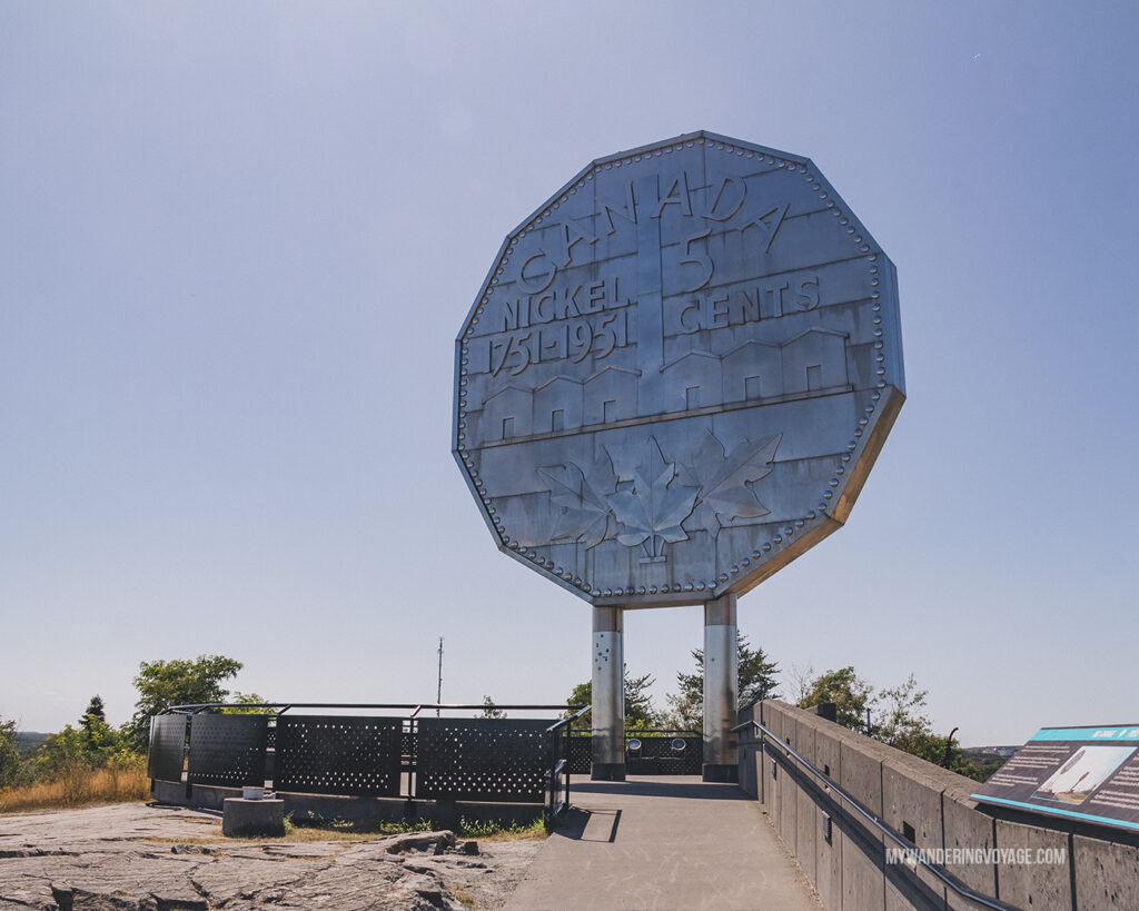
I love a great roadside attraction. And Sudbury delivers with the giant roadside Big Nickel. This nine-metre replica of a 1951 Canadian Nickle is something you just have to see for yourself. The coin commemorates Ontario’s nickel belt and was built for Canada’s centennial year. It’s one of three giant coins in Ontario.
A.Y. Jackson Lookout
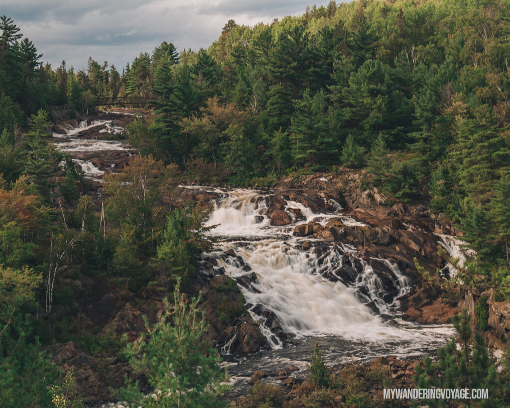
The next stop is a beautifully natural one at A.Y. Jackson lookout. This lookout over Onaping Falls near Sudbury is an example of the beauty of Northern Ontario. A.Y. Jackson, part of the famous Canadian impressionist landscape painters called Group of Seven, actually painted this scene in the 1950s. However, in the 1970s, the artwork, titled Spring on the Onaping River, was stolen and hasn’t been seen since.
While the stolen artwork still a mystery, you can explore this area on foot, part of the Sudbury Basin. It a meteor crash site millions of years ago, causing the area to be rich in metals. You can explore evidence of this crash on the trail around the Onaping Falls.
Where to stay overnight
There are a couple of parks in this area that you could camp at for the night. We chose to camp at Windy Lake Provincial Park, a quiet park located about 15 minutes north of A.Y. Jackson Lookout, known for the fishing in the adjacent lake. We weren’t there to fish, but we did explore some of the beautiful trails around the park.
Don’t want to camp? Here are some places you can stay in nearby Sudbury.
If you have time:
If you have time, keep heading north for about 30 minutes to check out Halfway Lake Provincial Park. This gorgeous park is popular with families. It was also the site of a 2002 tornado and 2007 wildfire.
We hiked Moose Ridge Trail, a moderate 2km loop trail that takes you up over a glacial ridge, providing stellar views over the park.
RELATED: Best Ontario Provincial Parks to visit in fall
Day two: Sudbury to Lake Superior Provincial Park
Driving time: 7 to 9 hours
Distance: 660km
Day two of the Northern Ontario road trip takes you from the Sudbury area, depending on where you stayed overnight, to Lake Superior Provincial Park. Today’s journey brings you to two waterfalls, an epic lookout and one of the coolest places along the shores of Lake Superior.
Chutes Provincial Park
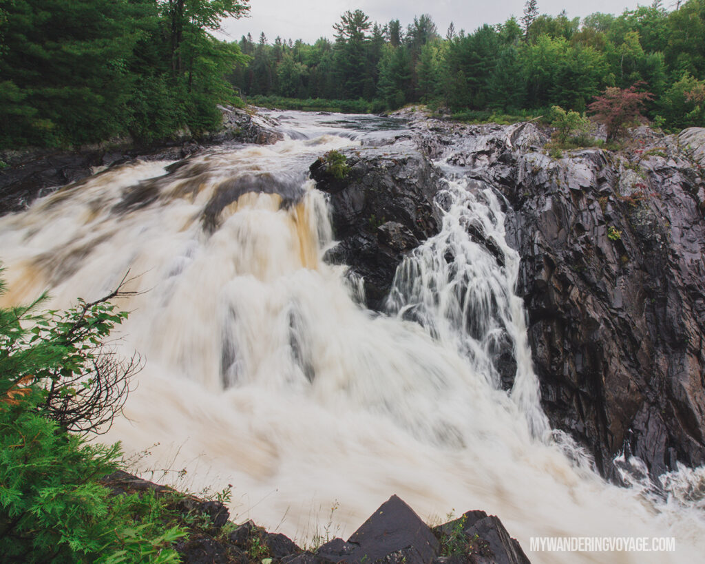
If there’s one waterfall you’ve got to see along the Toronto to Thunder Bay route, it’s the one at Chutes Provincial Park. This scenic waterfall and gorge was one of the loudest and expansive cascade waterfalls I’ve seen. Plus, the provincial park is located right off the TransCanada Highway, making it easily accessible.
If you have the time, hike the Twin Bridges Trail, which takes you to two bridges over the River aux Sables and the Seven Sisters rapids that lead into the Chutes Provincial Park waterfall. It is a 6km loop, but you could shorten it just to see the bridges if you like.
Elliot Lake Fire Tower
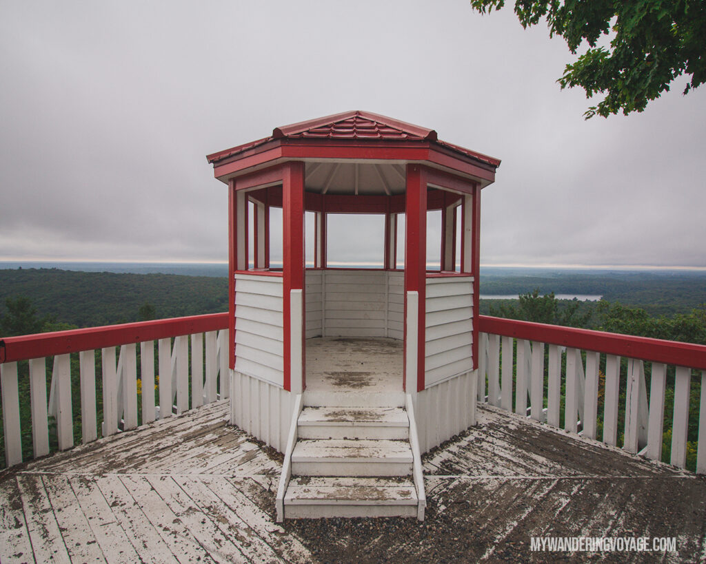
I had passed the sign for Elliot Lake many times but never took the chance to see it. After all, it is 30kms north of the Trans-Canada and adds on about an hour of driving. However, this year I decided, why the heck not. And I’m so glad we did.
Despite the rain, the views from the Elliot Lake Fire Tower were impressive. There are two parts to this lookout, a viewing platform that provides 360-degree views of the surrounding landscape, and the red and white cupola, offering similar views. On a clear day, you can even see Manitoulin Island in the distance.
Loon Dollar monument
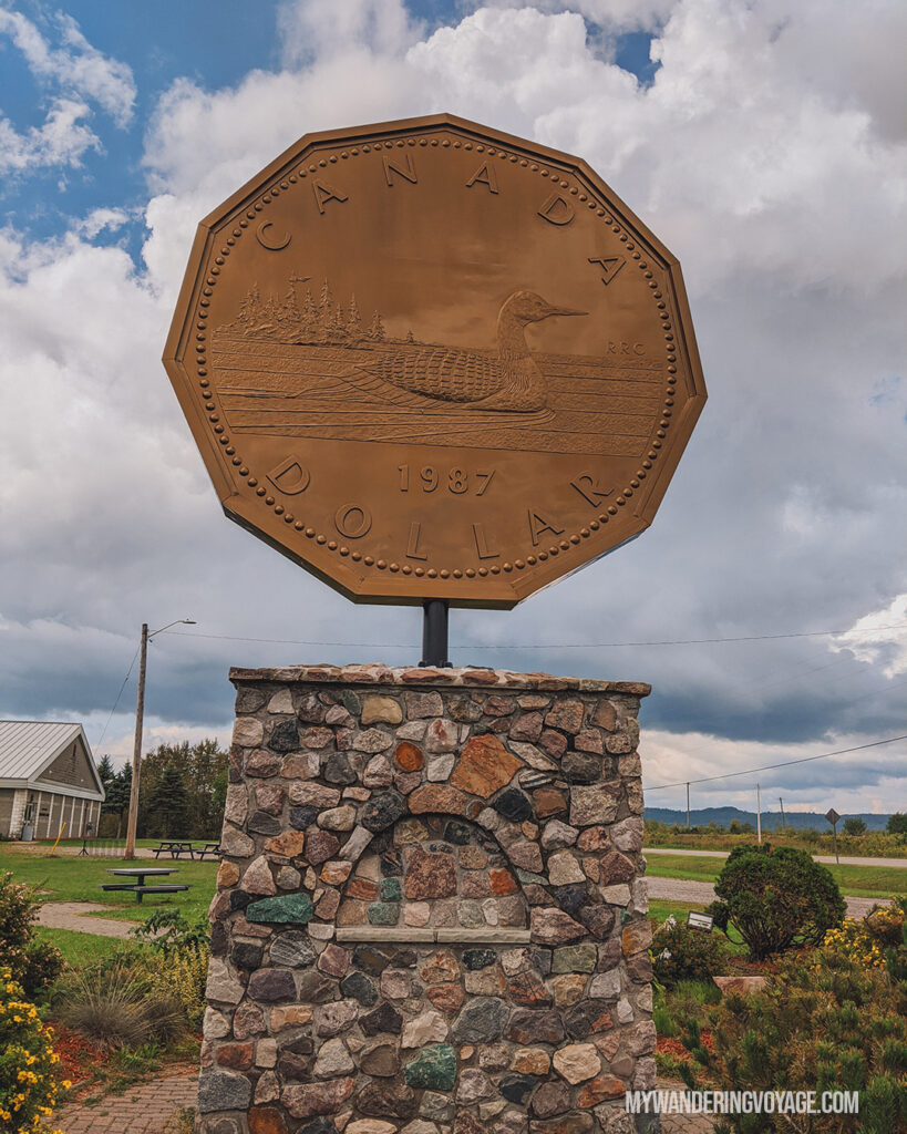
I’ll always stop for a roadside attraction, and the Loon Dollar Monument (aka Giant Loonie) in Echo Bay is one of them. In 2012, Canada marked 25 years of our beautiful gold coin, so a local artist constructed this giant coin to celebrate.
It’s exactly what you think it is, a giant coin off the highway. But it’s one of three giant coins in Ontario, and you won’t want to miss it.
Sault Ste Marie
This city, located on the shores of St. Mary’s River, connects Lake Superior and Lake Huron. It’s a gateway city, both into the United States and into the northern Lake Superior area of Ontario.
There’s so much to see and do in Sault Ste. Marie (even in winter!) that you could spend a full week here exploring the sites. Plus, Sault Ste Marie is the starting point for the incredible Agawa Bay Canyon Train Tour. Unfortunately, it was closed during our visit. The train tour would have also eaten up a full day of our 10-day Northern Ontario road trip, which we didn’t want to do because there’s so much to see from Toronto to Thunder Bay. But, *in Terminator’s voice* I’ll be back.
If you decide to stop in Sault Ste Marie, the Breakfast Pig was recommended as an excellent spot for a bite to eat. It’s also worth seeing the Sault Ste. Marie Boardwalk along the river and the Sault Ste. Marie Canal National Historic Site, a historic canal built in 1895, uses a series of locks to avoid the rapids.
Crystal Falls
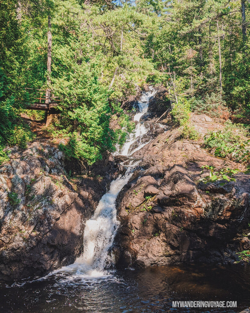
One stop you’ll want to make just outside of Sault Ste. Marie is at Kinsmen Park to see Crystal Falls. Jump onto this easy boardwalk trail to see a 15m high cascade waterfall. There are lots of viewing platforms and even a bridge at the top of Crystal Falls. It’s a great stop to stretch your legs and take in some stunning scenery.
Where to stay overnight
While are three campgrounds in Lake Superior Provincial Park, Agawa Bay Campground is my favourite. Crescent Lake (closed) and Rabbit Lake campground are located inland along individual lakes. But Agawa Bay is situated along the coast of Lake Superior. And I don’t think you can beat the views over the beach at sunset.
Don’t want to camp?
There aren’t too many other accommodation options near Lake Superior Provincial Park, since it’s such a large park. But in Wawa and Michipicoten, you can find motels and a few Airbnbs.
Day three: A day in Lake Superior Provincial Park
Driving time: 1h 30m
Distance: 130km
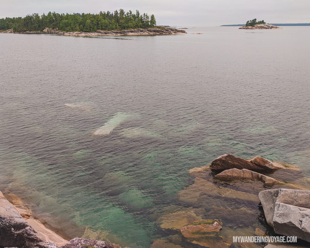
Lake Superior is a huge park, one of the largest in the province, which means you’ll want to spend a whole day here taking in the sights. But first a little bit of history. This park, when it was formed in 1944, had no roads. It is the traditional territory of Batchewana First Nation, who maintains harvesting rights in the parkland.
Today, the TransCanada Highway runs through the park north to south. Lake Superior Provincial Park has stellar hiking and excellent places to relax. Even on a whirlwind Northern Ontario road trip, a day or two to relax is needed.
Agawa Bay campground is located in the southern portion of the park. You’ll be heading north and then south again to explore the full park on today’s journey.
Lastly, if the weather is clear, be sure to go stargazing since Lake Superior Provincial Park is one of Canada’s dark sky preserves!
Visitor Centre
Your first stop in Lake Superior Provincial Park should be at the Visitor Centre. This beautiful wood and stone building near the Agawa Bay campground showcases Lake Superior’s power through the park’s cultural and natural history. The exhibits are beautiful, and you’ve got to check them out.
Agawa Pictographs
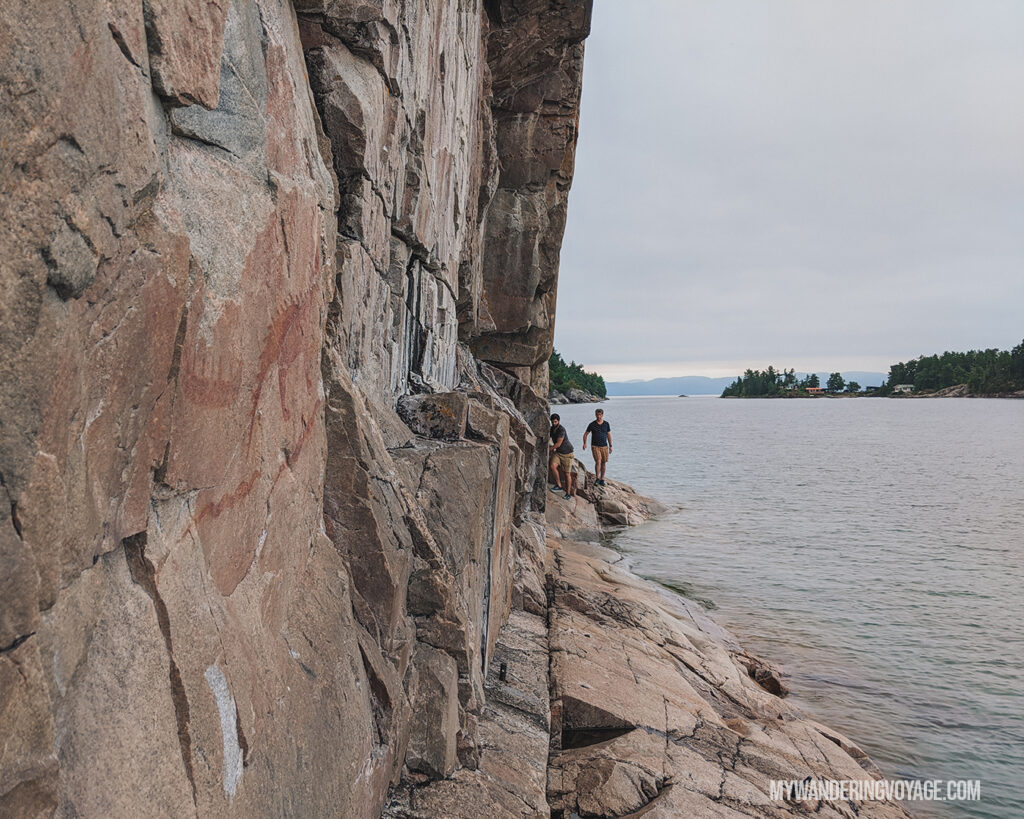
The next stop on today’s journey is at the Agawa Pictographs. Located near highway marker 1,098km, this trail teaches you about the area’s Indigenous history and takes you to a sacred place along the coastline.
This 500-metre loop is rated moderate due to its uneven, rocky terrain and steep sections. It can take anywhere from 30 minutes to an hour to complete.
At the end of the trail, you’ll come to Agawa Rock. It can only be reached on a rock ledge at the shoreline’s edge and when the waters are calm. Lake Superior is unpredictable, and the weather can turn nasty in an instant.
Lake Superior, Gi chi Gamiing, is still vital to Ojibwe peoples. Agawa Rock is a stone canvas on the shoreline of Lake Superior, used for millennia to record history and momentous events. The largest and most defined painting is of Misshepezhieu, the horned lynx, the spirit of the water. These are sacred messages dating back 150 to 400 years, so DO NOT TOUCH THEM.
Sand River Falls
The next stop is Sand River Falls, located near highway marker 1,090km. This easy linear trail is a longer one, totalling 6km return. But because it’s linear, you can make it as long as you’d like. The trail follows Sand River, where you’ll see the first waterfall shortly after the start of the trail, and there are two more waterfalls along the remainder.
Old Women Bay
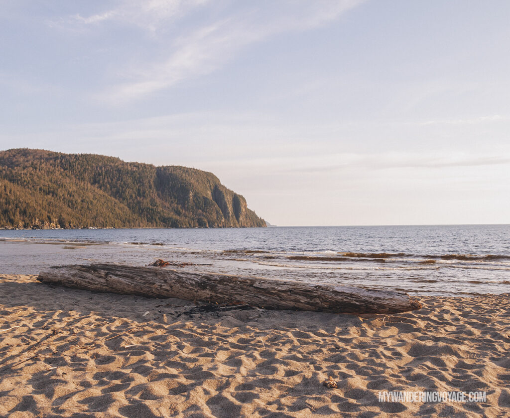
You’ve got to check out the Old Women Bay day-use area, located near highway marker 1,042km. This sandy/pebbly beach is a great stop for a picnic. It’s easily accessible from the highway and always has some stellar views of the surrounding cliffs.
Nokomis Trail
Once you’re finished with your picnic, leave your car in the parking area and head over to Nokomis Trail. This 5km moderate loop trail takes you to a scenic lookout over Lake Superior. There are steep climbs on this trail, rising about 200 metres above Lake Superior, but you’ll be rewarded with incredible views along the way.
Katherine Cove
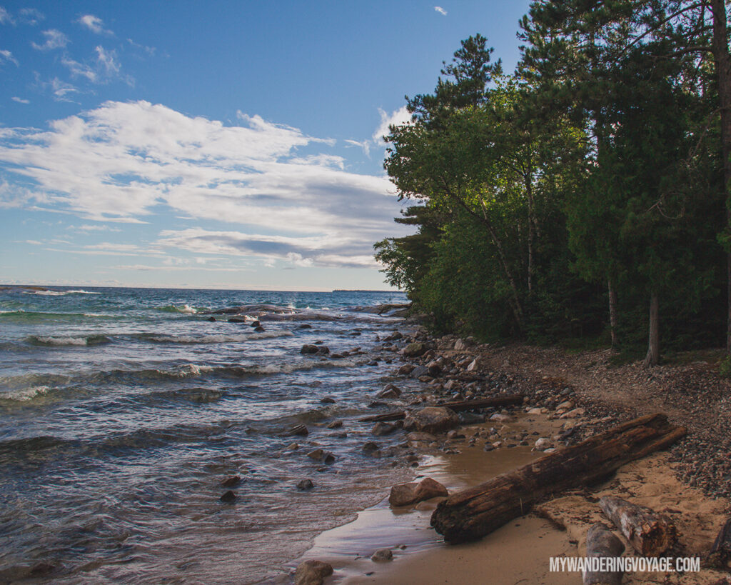
After a full day of hiking and exploring, it’s time to relax at Katherine Cove, known for the famous Bathtub Island.
Katherine Cove is a shallow sandy cove that is perfect for swimmers. On a calm day, you can walk right out to Bathtub Island, an island made from a slab of rock with a depression in it, making a shallow bathtub for swimmers!
On a windy day or when the waters are rough, you’ll have to stay close to shore, since the waves and riptides can be unpredictable. But it’s worth the trip, just to see the power of the waves.
RELATED: Travel to Dark Sky Preserves in Canada and see the stars without light pollution
Day four: Lake Superior to Pukaskwa
Driving time: 4h 30m
Distance: 389km
On day four of the 10-day Northern Ontario road trip, it’s time to say goodbye to Lake Superior Provincial Park and head to Ontario’s northernmost national park. There are a couple of stops along the way you’ll want to see, including waterfalls and roadside attractions.
Magpie Falls/ Scenic High Falls
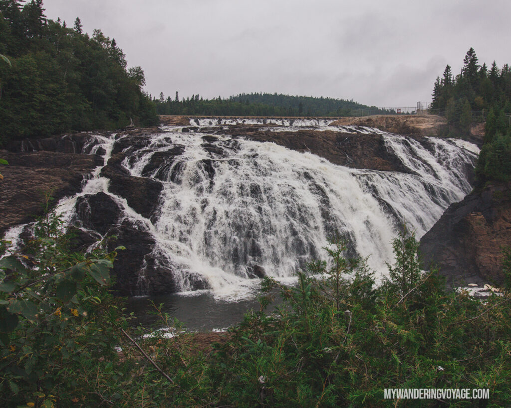
Magpie Falls is a waterfall just outside of Wawa, off the beaten trail. In fact, you might take a beating getting to the waterfall in the first place. The road there is a rough gravel road, but you won’t want to miss this enormous cascade waterfall. Once you’re there, you can take in the sights at a viewing platform, and learn about how this waterfall isn’t all it seems.
The Wawa Goose
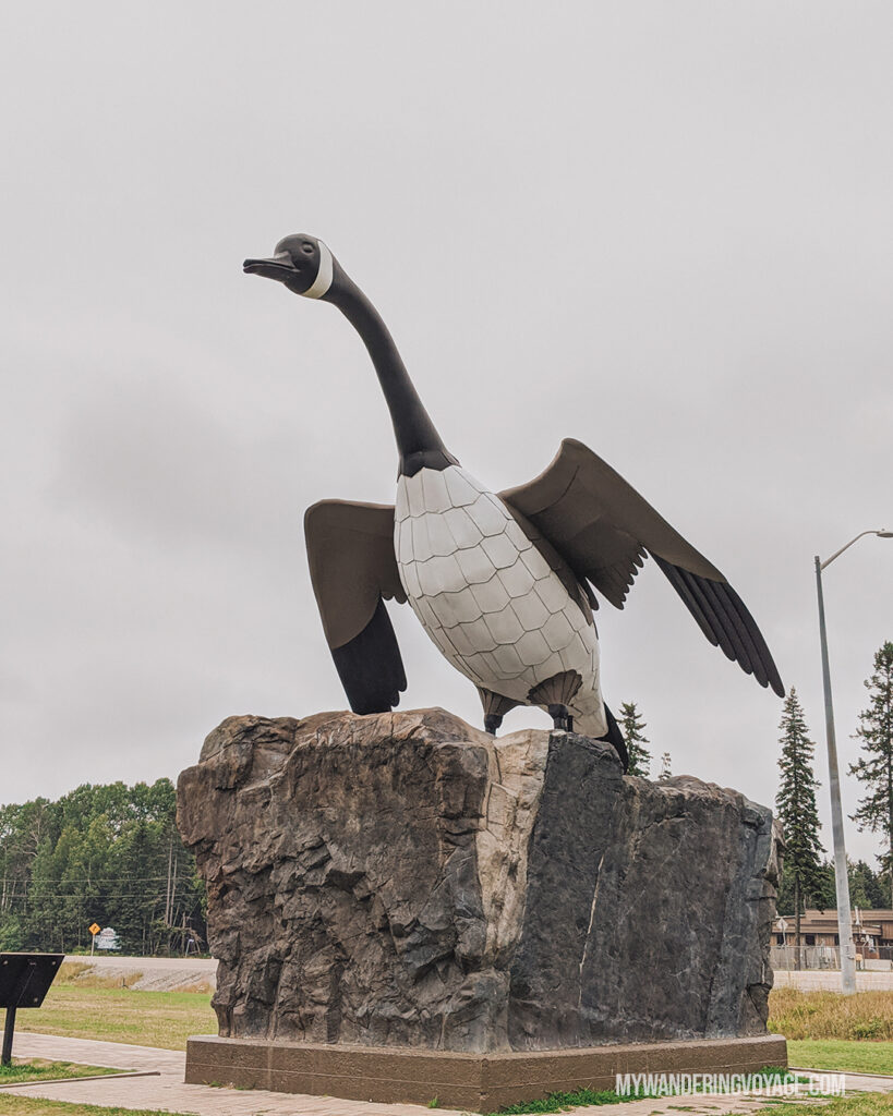
If there’s only one roadside attraction you stop for on your way from Toronto to Thunder Bay, then let it be at the giant Canadian Goose in Wawa. Learn about the Wawa Goose history and take in views of the TransCanada Highway from this fantastic lookout.
Potholes Provincial Park
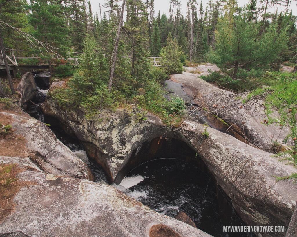
Ready for a detour? Potholes Provincial Park is a remarkable geological wonder that is about a one-hour detour. However, don’t trust Google Maps to get you there. If you search for Potholes Provincial Park, it’ll take you to the administration office near Chapleau. The coordinates are 47° 57’30.6 “N 84°16’05.9″W, about 51kms from the Highway 101 turn off in Wawa.
The trail is an easy 300m in-and-out trail that will take you along these incredible rock formations caused by glacial meltwater. They look like perfectly round holes in the ground, and it’s impressive to see the power water has. A little further upstream, you’ll find the boulders, a field of jagged rocks left there by retreating glaciers.
It was just a great place to visit, and we had the whole place to ourselves, making ourselves a great little picnic before setting off again.
White River Pooh Bear
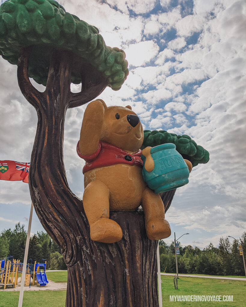
There are two roadside attractions in White River. The first is a giant thermometer. Why, you might ask? Well, for a long time, White River had recorded the coldest temperature in Canada at a whopping -58 degrees Celsius. Or at least it thought it did. There’s disputing evidence against that, but even still -58 is frigid, and I don’t think I could stand it!
White River is most known for its connection to Winnie the Pooh. I think this story is rather sad and not endearing like it’s meant to be. But in 1914, Captain Harry Colebourn bought a trapped bear cub and named it Winnie after his hometown of Winnipeg. He then donated her to the London Zoo. At the zoo, A.A. Milne and his son Christopher Robin Milne visited Winnie and was inspired to write his children’s books, Winnie-the-Pooh.
White River has a statue of Winnie the Pooh, and you can see it in the gardens off the highway.
Where to stay overnight
After a relatively short day, pull into Pukaskwa National Park, the northernmost national park in Ontario. It’s also the least visited. Of the six national parks that call Ontario home, Pukaskwa feels the most remote. This park is a perfect example of rugged Lake Superior shoreline, and this is the perfect spot to camp for the next two nights.
You cannot reserve a campsite here in advance; it is a first-come-first-serve system. Find out what that means and what to do when you get there in this post about everything you need to know about Pukaskwa National Park.
Day Five: A day in Pukaskwa National Park
Driving time: 0 hours
Distance: 0km
You won’t do much driving today, but you will want to take a hike. A big hike.
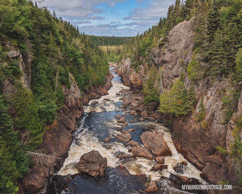
Deep in the woods of Pukaskwa National Park, there is a suspension bridge spanning 30 metres across the White River gorge and hangs 23 metres above Chigamiwinigum Falls. But to get there is quite the feat. The 18km in-and-out trail, part of the Coastal Hiking Trail, takes between 6 and 9 hours of hiking on a difficult trail. Let me tell you, the views were so worth it.
However, if you’re not up for such a long hike, you can check out several over trails in Pukaskwa National Park that will bring you to some incredible viewpoints along the coast.
Enjoy your day and soak up as much of the park as you can. This stop was my absolute favourite part of the trip.
RELATED: Everything you need to know about Pukaskwa National Park
Day Six: Pukaskwa to Sleeping Giant
Driving time: 4 to 6 hours
Distance: 332km
Say farewell to Pukaskwa National Park and buckle up for the trip to Sleeping Giant Provincial Park. This part of the 10-day northern Ontario road trip takes you along the north shore of Lake Superior. This section of the Toronto the Thunder Bay road trip takes you to a former POW camp, two awesome waterfalls and a canyon that will BLOW. YOUR. MIND.
Neys Provincial Park
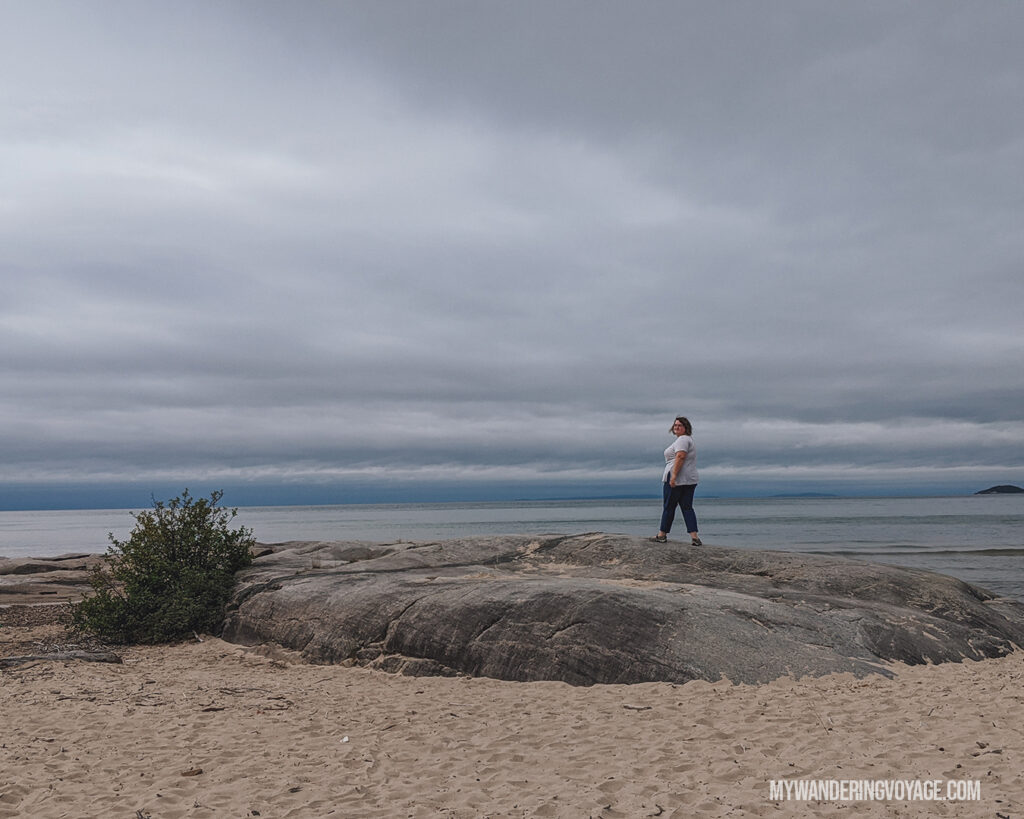
Your first stop on day six of the Northern Ontario road trip is at Neys Provincial Park, an underrated park along the shores of Lake Superior. Not only does Neys have incredible views, but there’s quite a bit of history here.
From 1940 to 1947, this spot was where Canadians detained tens of thousands of prisoners of wars; Neys Provincial Park was one of these POW camps. Many detainees commented on Canada’s humane treatment of the military prisoners, which prompted these former prisoners to immigrate after the war.
At Neys, you can pick one of several of their trails to explore. I suggest Lookout Trail, a 1.6km moderate trail that takes you to a scenic lookout over Lake Superior. If you have more time, trek to Pic Island Overlook Trail, a 9km in-and-out trail that takes you up a dirt road to Pic Island Overlook, a breathtaking spot that inspired Group of Seven painter Lawren Harris.
Lastly, in the Visitor Centre, you’ll be able to check out a model of the POW camp and learn about the history of the place.
Aguasabon Falls
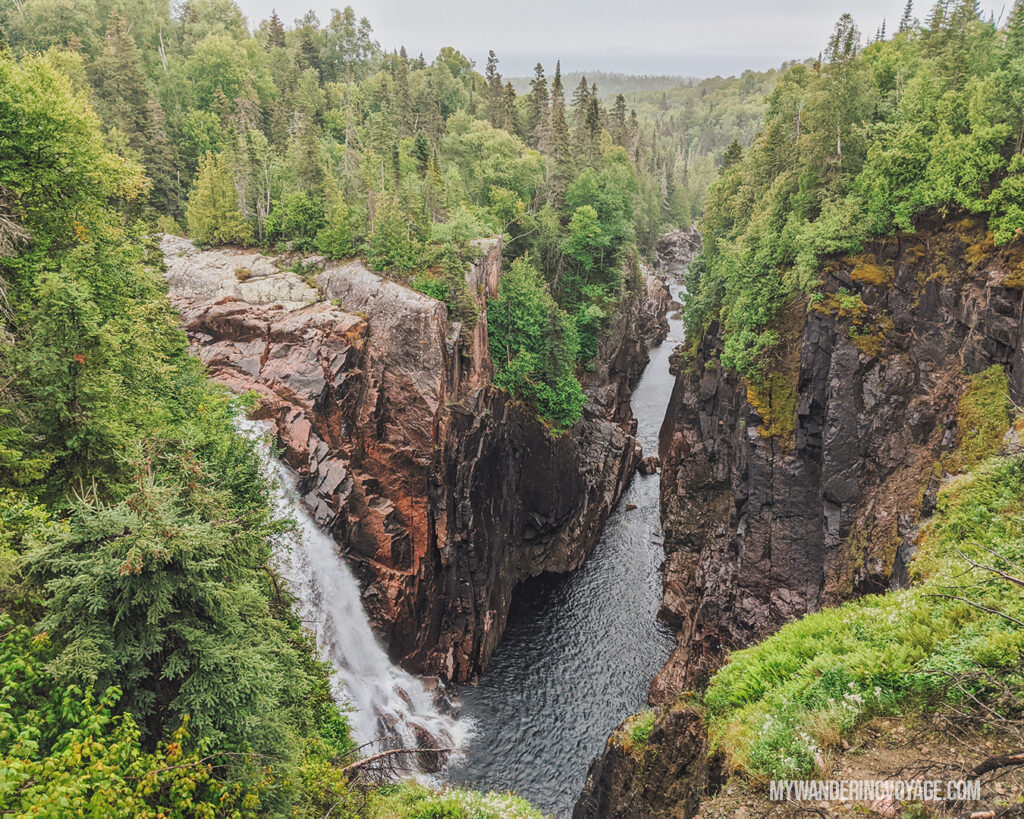
For a quick stop off the TransCanada Highway, Aguasabon Falls packs a punch. This 100-ft waterfall and rushes into the gorge creating this incredible sound. Getting to the Falls is simple; just follow the boardwalk until you get to the overlook.
If you have more time, you can walk the 3.25km round trip trail to Terrace Bay Beach, where you’ll see even more waterfalls along the trek. You can even drive to Terrace Bay Beach if you would rather not walk.
Rainbow Falls Provincial Park
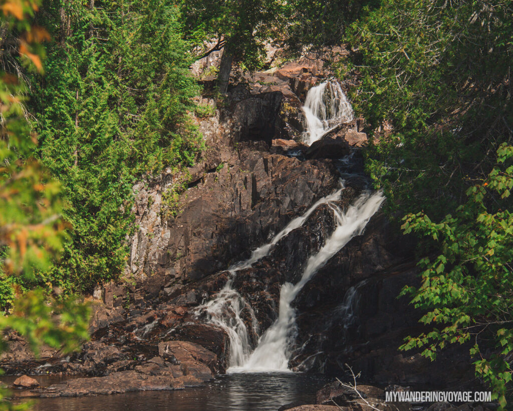
Rainbow Falls Provincial Park is divided into two sections on either side of the TransCanada Highway, and you’ll want to stop at both.
The Whitesand Lake campground, on the north side of the highway, hugs Whitesand Lake. Here, you’ll want to make sure you stop at Rainbow Falls. It’s a short trek on a boardwalk to get to the viewpoint over the waterfall. You’ll also understand why they call this Rainbow Falls since there are so many colours in the rock.
Don’t miss checking out the Rossport Campground side of Rainbow Falls Provincial Park. The view of the pink granite fading into the bright blue waters of Lake Superior shouldn’t be skipped!
Nipigon Lookout Tower
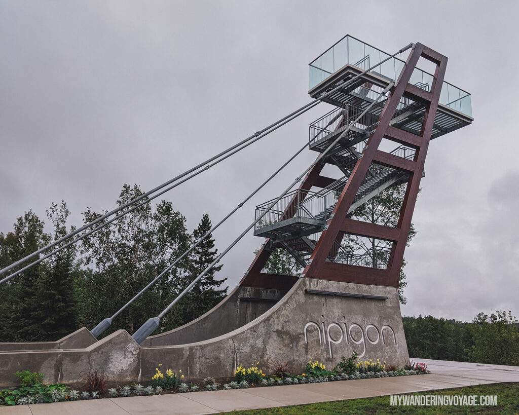
The Nipigon Lookout Tower is relatively new, built only in 2018. From the top of the 12-metre tower, you can see the gorgeous view of Lake Helen and the Nipigon River. The scenic lookout tower is a quick stop off the highway, but a great one to stretch your legs and see the beautiful scenery.
Ouimet Canyon
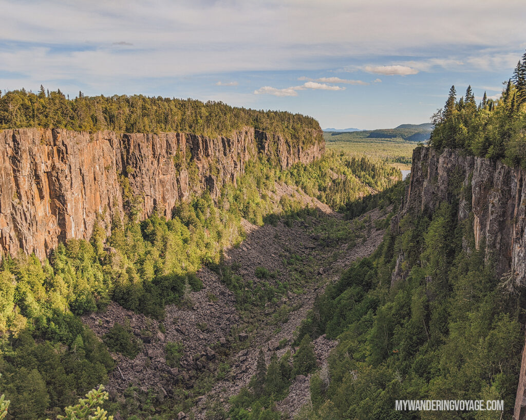
The last stop of the day is at Ouimet Canyon Provincial Park. I don’t know what I was expecting; I had seen photos. I had seen it from Google Maps. But nothing prepared me to visit this place in person.
Ouimet Canyon is a 100-metre deep, 150-metre wide naturally forming scar on the earth made by glaciers and erosion. Looking down into the floor of the canyon is a mind trip. It’s so hard even to comprehend how deep it is, and yet, on the floor, you’ll find arctic plants surviving in the mini-ecosystem.
The trail is short, just over a kilometre, which takes you to two incredible viewpoints over the canyon and across a beautiful little bridge.
Where to stay overnight
After Ouimet Canyon, head to Sleeping Giant Provincial Park. The campground for this park is situated on an inland lake. And to be honest, the campground is looking a little tired. It’s perfectly situated for exploring the park and surrounding area, but there are a couple of things I didn’t like about it.
For example, there are only two comfort stations for the entire campground and vault toilets scattered throughout. These were extra smelly and could do with a refresh.
But the beach area was large and beautiful, and the views from our campsite over the lake were wonderful. I still recommend camping in the park, since it makes getting around the park super easy, but it’s not your only option.
You could spend a few nights in Thunder Bay, which is just over an hour east of the park. There are several places for you to rest your head in Thunder Bay:
Day Seven: Parks around Thunder Bay
Driving time: 4 to 6 hours
Distance: 334km
Our original plan was to hike in Sleeping Giant Provincial Park on day seven of our Northern Ontario road trip. However, we needed an extra rest day for our legs to tackle the 22km trek to the top of the giant. So we switched our plans and took off in search of rocks and waterfalls.
Today, you make it to the most eastern point of your Toronto to Thunder Bay road trip! After today, you’ll start heading back south, back to reality, but don’t fret! There are still some fantastic sites to see on Lake Superior.
Terry Fox Memorial
Your first stop of the day should be at the Terry Fox Memorial. Terry Fox is a Canadian Hero with a capital H. He was diagnosed with cancer at a young age, and his leg was amputated. In 1980, he dipped his toes in the Atlantic Ocean at St. John’s Newfoundland and ran across Canada to raise money for cancer research.
However, half-way across his journey, outside of Thunder Bay, he was forced to stop his journey as cancer had spread to his lungs. He died in 1981 at the age of 22. Today, communities across Canada take part in the Terry Fox Memorial run to raise a Toonie for Terry for cancer research.
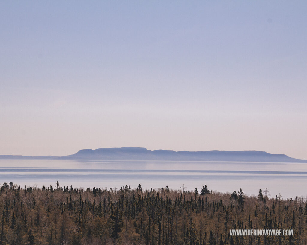
This memorial outside of Thunder Bay is a perfect way to honour his legacy. It’s impressive to see how far he had come. The monument also offers breathtaking views of the Sibley Peninsula, aka the Sleeping Giant.
Pigeon River Provincial Park
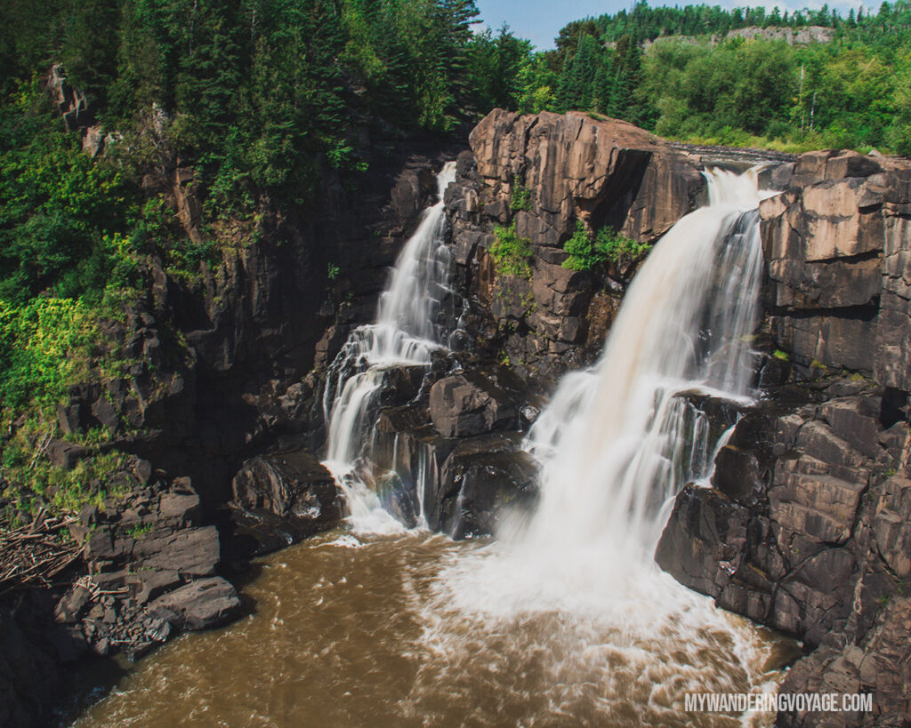
How do you get to Pigeon River Provincial Park? Drive until you almost hit the US/Canada border, and then you arrive!
Pigeon River has got to be the weirdest provincial park I’ve been to. It sits right on the border between the United States and Canada, and both countries have a park dedicated to it.
On the Canadian side, you park at the Ontario Information building, located less than 300 metres from the border and walk along the trails into the park. There are several trails here, but I suggest hopping on the High Falls trail. This 2km trail takes you under the highway and along an old logging road to a picturesque viewpoint over High Falls.
From here, you can see the US; it’s literally so close! They also have a viewpoint over the falls, but after looking at pictures online, I think our view is better (sorry, not sorry).
Along the trail, you’ll learn about the logging history in the area and also come across a chimney from the old resort that used to be here over 100 years ago.
Kakabeka Falls
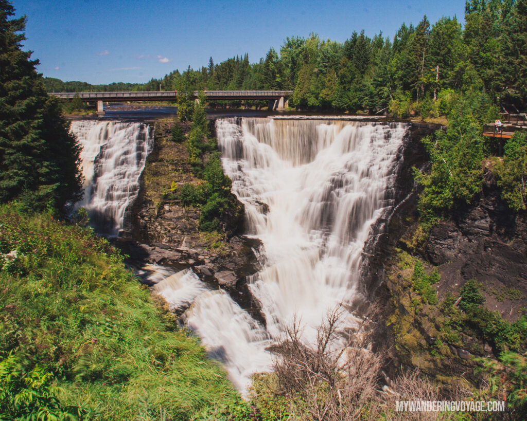
Two waterfalls in one day? Why not? Kakabeka Falls was magical, it’s enormous, and I understand why it’s called the “Niagara of the North.”
The Falls are located inside Kakabeka Falls Provincial Park adjacent to a town with the same name. It’s an accessible park, with huge boardwalks around both sides of the gorge, so you get optimal viewing of the 40m (130ft) drop of the waterfall.
Some of the world’s oldest fossils were found here thanks to the fragile, eroding rock in the gorge. During the fur trade, voyageurs would portage this waterfall; you can follow that same trek on the Mountain Portage Trail, a 1.25km loop that takes you to beautiful vistas of the river, gorge and the waterfall.
Amethyst Mine
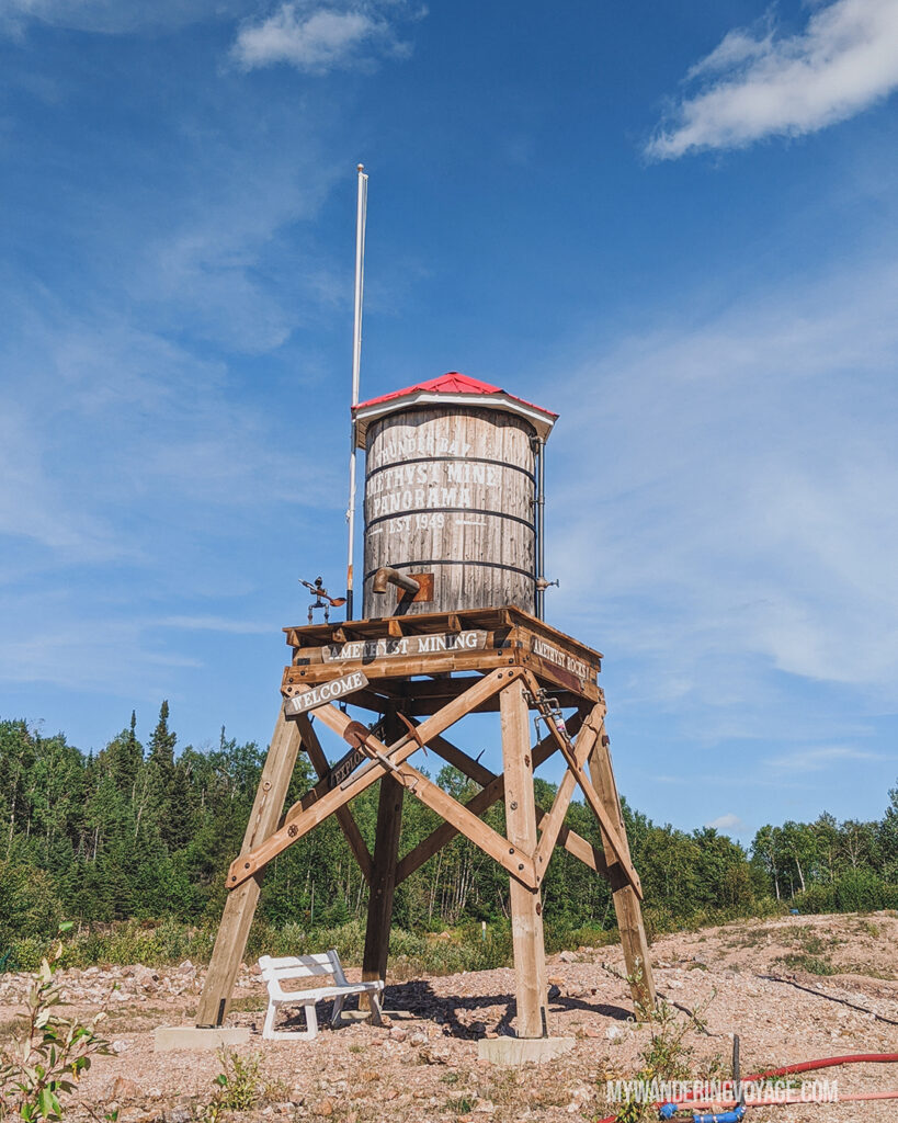
I never thought I’d enjoy picking through rocks, but going to an Amethyst Mine was one of the coolest experiences I’ve had.
There are several Amethyst Mines you can visit, but we chose Amethyst Mine Panorama, just west of the road to Sleeping Giant Provincial Park. And I admit, it is the most touristy thing in the area. You pay to go pick up rocks and get a tour, but it was surprisingly really cool.
Panorama is open from May to September, from 10 am to 5 pm and costs $10. Any Amethyst you’d like to take home costs $4/pound.
Amethyst Mine Panorama is the largest deposit of Amethyst, a beautiful purple gem, in Canada. It was found in 1955 when workers were building a road to a wildfire lookout tower. Five years later, The family that owned the property (and still owns it today) started the mine operation.
Surprisingly, the mine isn’t that large. Most the Amethyst is found along a “scar” about 300 metres long. At the mine, you’ll learn about how the gem is made, how it’s mined, and the history of the property. You’ll see massive amethyst chucks, larger than a person, and you can even “dig” for your own Amethyst in a rock field. I say “dig” loosely, because you can literally bend down and pick up a handful of tiny amethyst pieces without moving your feet.
RELATED: Epic road trips in Canada you need to take
Day Eight: Hiking in Sleeping Giant
Driving time: 0 hours
Distance: 0km
Sibley Peninsula is known for its massive rock formation, aka the Sleeping Giant. Sleeping Giant Provincial Park offers 100km of trails weaving around the park, including the famous Top of the Giant Trail. And that’s what today’s goal is, getting to the top of the giant and seeing the views of Lake Superior.
Welcome to the tallest cliffs in Ontario. The Knees of Sleeping Giant Provincial Park are 563 m (1,847 ft) tall, and the surrounding Lake Superior views are breathtaking.
But you have to work for this view. It was the most challenging hike I’ve ever done, and not in the way I expected.
How to get to the Top of the Giant
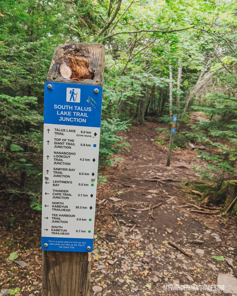
Set off on your journey by heading to the trailhead parking lot, then set out on the Kabeyun Trail.
The first 7.5kms of the trip were on a flat but rocky trail, wide enough for a car. Other than the quick jaunt down the Sea Lion Trail to see the Sea Lion rock formation, there’s not a whole lot to see. Follow the Kabeyun Trail to the trail junction, where you’ll follow the Talus Lake Trail for a short distance to the trail junction for the Top of the Giant Trail.
Once you head up the Top of the Giant Trail, which is only 3.3km from the trailhead, you climb the full height in just a short distance. The trail switchbacks up the side of a cliff, and the rainy day made it a bit slippery.
The views at the top were jaw-dropping. I loved staring down into the gorge and seeing how far down it really was. It was a mind-trip to see all the way to the bottom.
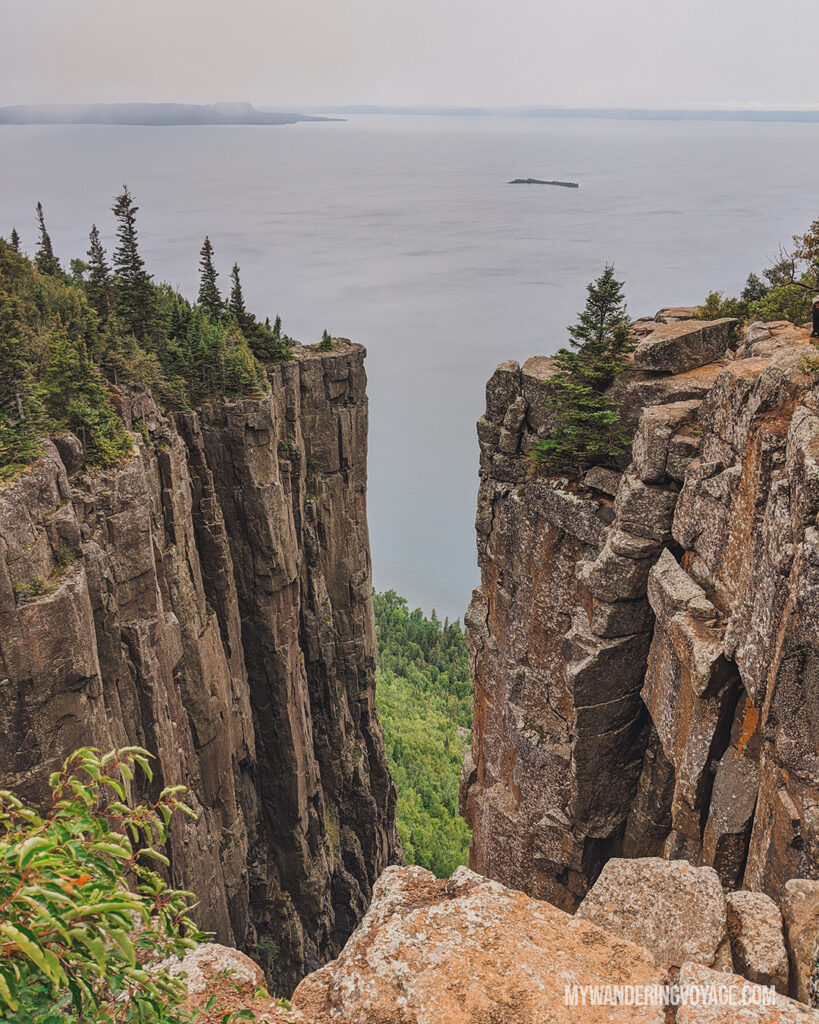
Heading down the trail was tough too. The drizzle continued, making it extra slippery, and once we got down to the flat part, it was like a celebration.
But the hardest part was ahead. The 7.5kms return hike felt never-ending. Both my friend and I SWORE we saw the sign for the sea lion (meaning there would only be 700m left of the trail.) But it was 100% a mirage, and we still had 2kms to go.
When we got back to the car, exhausted, we burst into a fit of laughter. For a solid 10 minutes. In total, the trek took us about 8.5 hours. It was a mentally challenging trail rather than physically demanding, and that’s what exhausted us the most. Was it worth it? Hell yes. Would I do it again? Ask me again in a couple of years.
Don’t want to hike this trail?
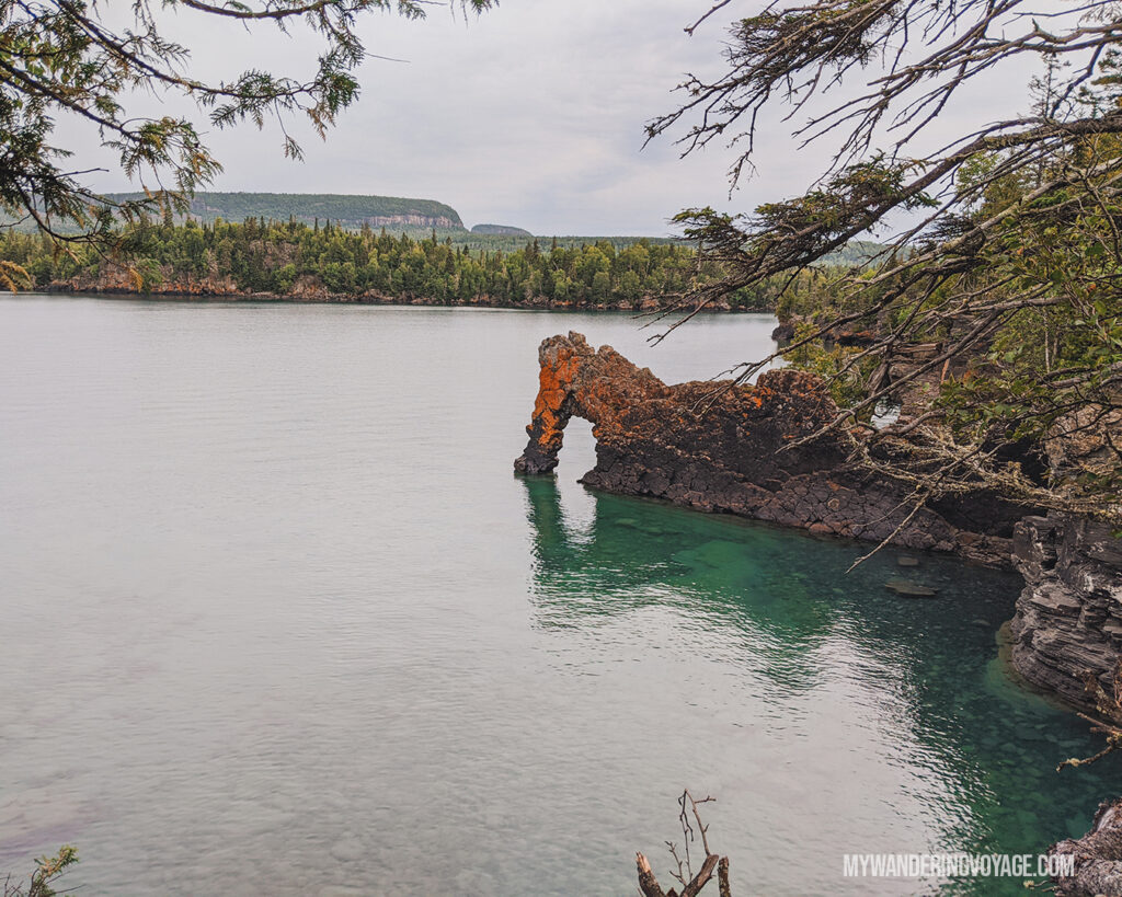
You can get a taste of the trail by hiking to see the Sea Lion, an impressive rock formation with the Sleeping Giant in the background. Or check out one of the many other trails in the park! You won’t regret it!
RELATED: Why you Should use a Hiking Log for your Adventures
Day Nine: Sleeping Giant to Pancake Bay
Driving time: 7 to 9 hours
Distance: 630km
It’s time to start the sad journey home. Because it takes so long to travel from Toronto to Thunder Bay, the homeward bound journey takes two full days of driving. But there are still a few places left to stop! This part of the 10-day Northern Ontario road trip takes you back along the TransCanada Highway.
Thunder Bay lookout
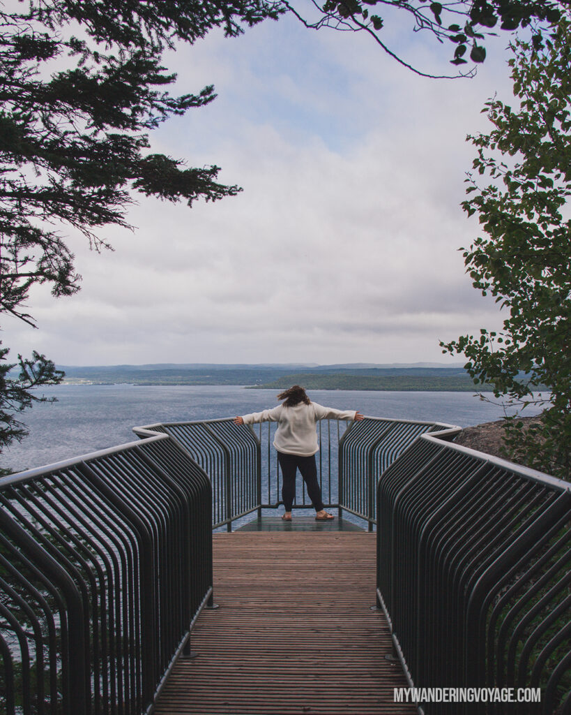
But first, before you leave Sleeping Giant Provincial Park, you’ve got to take the journey to visit the Thunder Bay lookout.
Located at the end of a 9km dirt road, this lookout was my absolute favourite stop of the entire trip. The road to get there was insane, however. If you have a car with low clearance, I’d stay away from visiting this, but if your vehicle can handle a rough road, then you won’t want to miss it.
Once you get to the lookout, there’s a short path that opens up to a viewing platform hanging over the cliff. I felt like I was flying, because the winds whip around you and the cliffs, tossing your clothes and hair in wild directions. It was honestly the best feeling.
Where to stay overnight
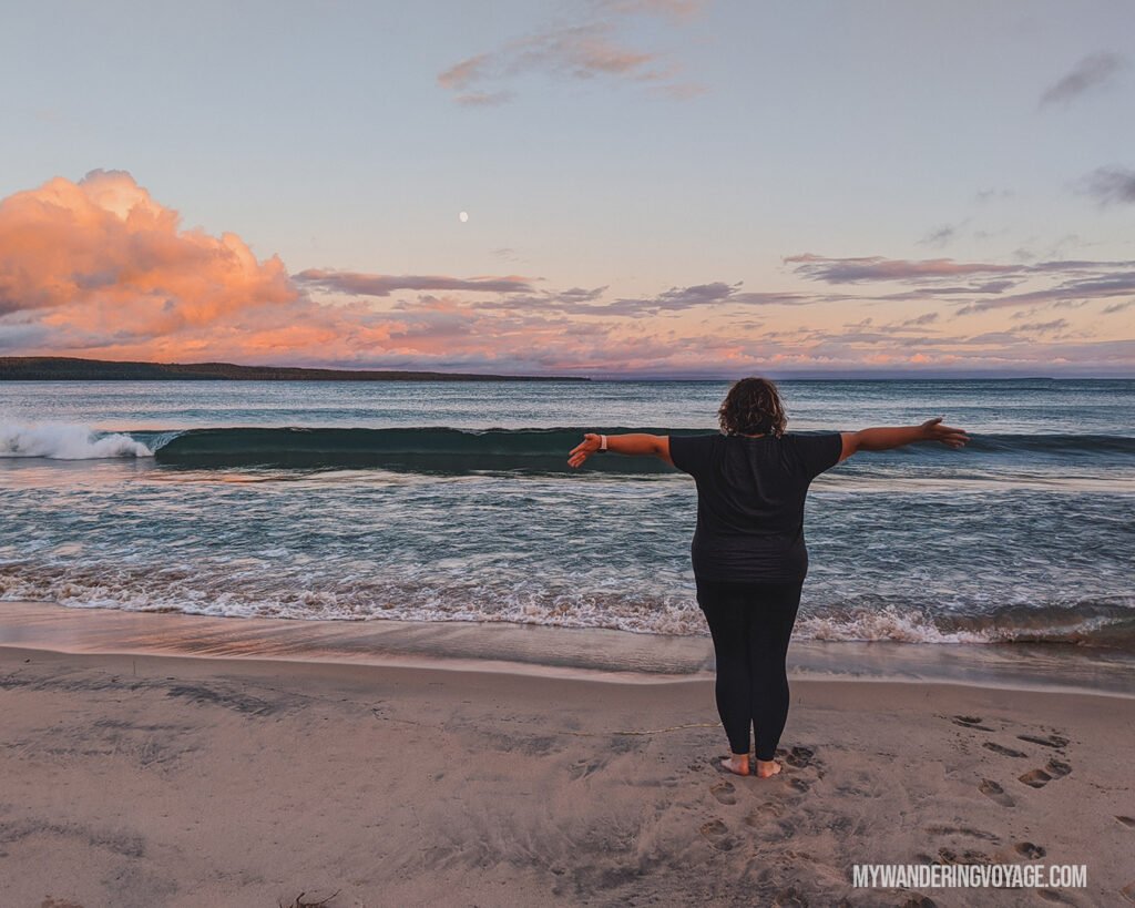
Deciding where your half-way point is between Toronto and Thunder Bay is up to you. You can decide to camp at one of the many parks, like we did, or grab a place to stay in Sault Ste Maire.
We decided to camp at Pancake Bay Provincial Park, arriving shortly before sunset. Lake Superior was alive that evening, with the eight-foot-tall waves crashing against the shore. Pancake Bay was more protected, but the waves were still huge!
Our site was right next to the beach pathway, and we used it to visit the beach for sunset, stargazing, and sunrise.
If you’d rather keep going to Sault Ste Marie, there are several options where you can rest for the night:
Day Ten: Pancake Bay to home
Driving time: 8 to 10 hours
Distance: 770km
Well, you’ve reached the final day of the 10-day Northern Ontario road trip. You’ve gone from Toronto to Thunder Bay and back again. But there are still a few more stops you can make on this long day/ But because it’s a long day, these stops are super simple. They are both located just off the highway, so you won’t have to venture too far.
Batchewana Bay Provincial Park
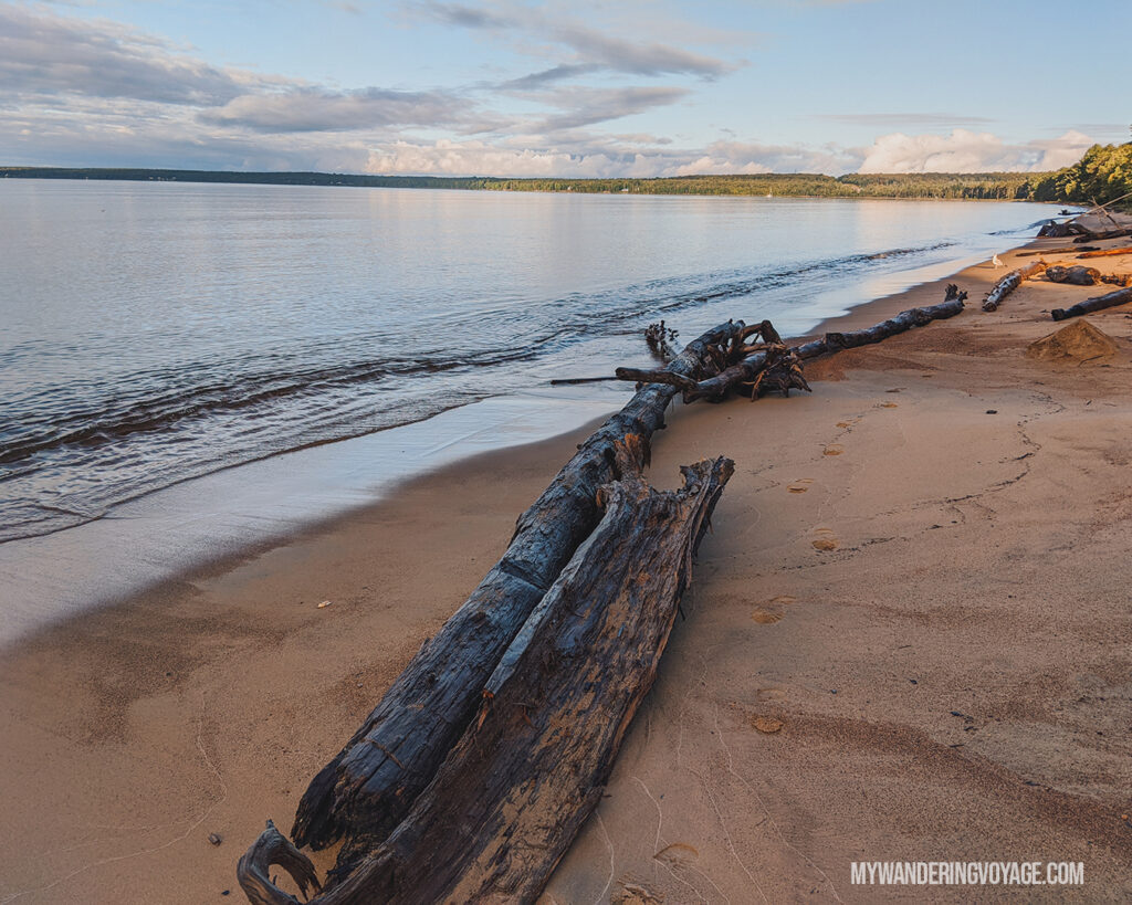
The first stop of the day is Batchewana Bay Provincial Park. Located just minutes from Pancake Bay, this beachy park is a calm cousin to the larger Pancake Bay. It was so quiet in the morning, but there’s not much to do except lounge on the beach, which we didn’t have time for. We wandered the shoreline for a while before jumping back into the car.
Chippewa Falls
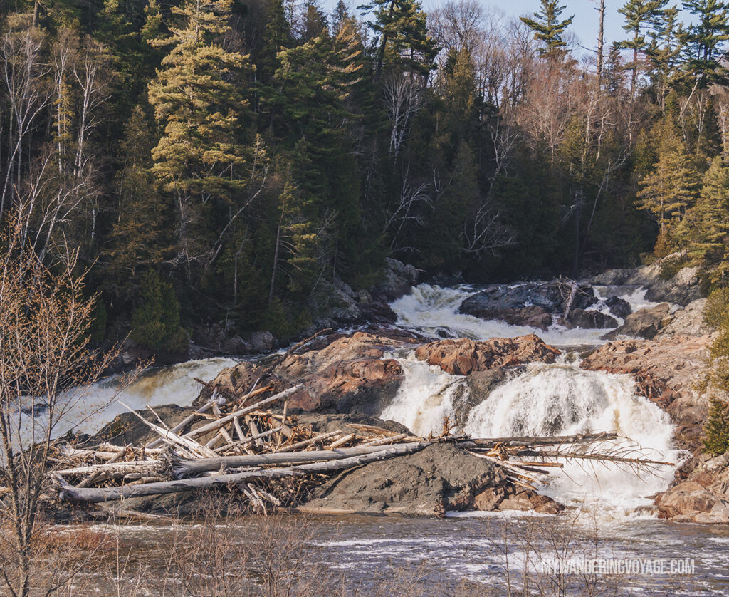
The second stop is Chippewa Falls. This short waterfall is located right off the highway, and while it doesn’t seem as impressive as some of the other waterfalls we’ve seen on this Northern Ontario road trip, it certainly marks something important.
The TransCanada Highway runs from St. John’s, Newfoundland to Victoria, British Columbia and Chippewa Falls, just north of Sudbury, Ontario, marks the half-way point between the two. It’s incredible to think about how large this country really is.

The Best of Lake Superior Road Trip
After 3,550 kilometres of driving, 1,202 photos taken, 118 kilometres hiked, we visited 14 provincial parks, one national park, 11 waterfalls and took two chilly dips in Lake Superior, this 10-day Northern Ontario road trip was the highlight of my year.
Even though I’ve driven this route several times in the past, there were so many new things to explore, and we saw some pretty incredible places. We spontaneously added things; we crossed off others because of the weather or lack of time.
Overall, this 10-day Northern Ontario road trip brings you the best of Lake Superior. Of course, there is plenty more to see in this gorgeous area of the province. But when you have limited time, this itinerary takes you to some of the best places from Toronto to Thunder Bay.
